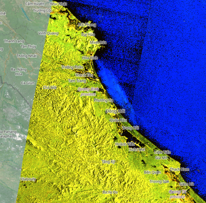
Flooding in Central Vietnam has become a primary concern as provinces from Hà Tĩnh to Quảng Trị continue to experience prolonged heavy rainfall, causing severe impacts on livelihoods and infrastructure. From late October to early November 2025, the region was affected by multiple extreme rainfall events, leading to rising river levels and widespread inundation. Sentinel-1 radar satellite imagery from the European Space Agency (ESA), acquired at 05:44 on November 02, 2025 captured the extent of flooding, particularly in southern Hà Tĩnh and Quảng Trị.
Overview of Flooding in Central Vietnam from Sentinel-1 Imagery
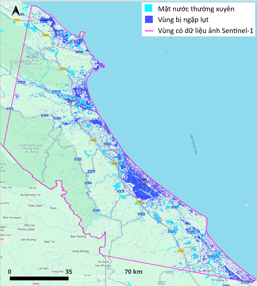
Sentinel-1 satellite imagery with a 10 meter resolution enables clear identification of large-scale inundated areas. Preliminary analysis indicates severe flooding in Central Vietnam, notably in:
- Southern Hà Tĩnh Province, especially around the communes of Kỳ Anh, Kỳ Khang, Hải Ninh, and the wards of Sông Trí and Vũng Áng.
- Quảng Trị Province, with flooding concentrated in the Gianh, Kiến Giang, Bến Hải River basins, and a small portion of the Thạch Hãn River basin.
(Note: This is a quick analysis product and has not been validated by field observations. Flooded residential areas have largely not yet been delineated.)
Significantly Impacted Areas
 |
 |
|
(1a) Sentinel-1 image acquired at 05:44 on November 02, 2025 over southern Hà Tĩnh and Quảng Trị Province |
(1b) Flood extent extracted from Sentinel-1 imagery |
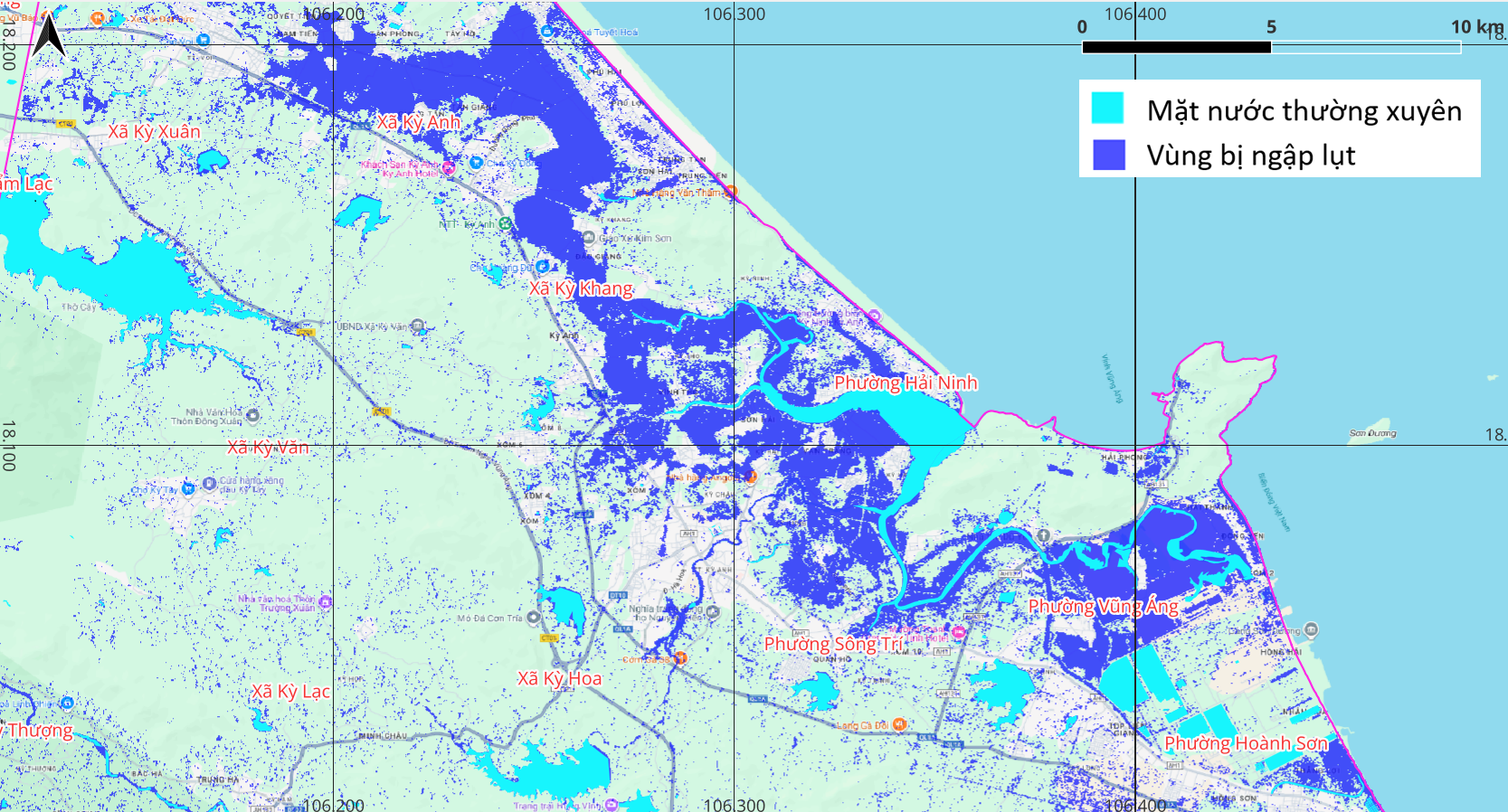
Figure 2. The communes/wards of Kỳ Anh, Kỳ Khang, Hải Ninh, Sông Trí, and Vũng Áng (Hà Tĩnh Province) are extensively inundated. These coastal areas are directly affected by tidal influence combined with prolonged rainfall.
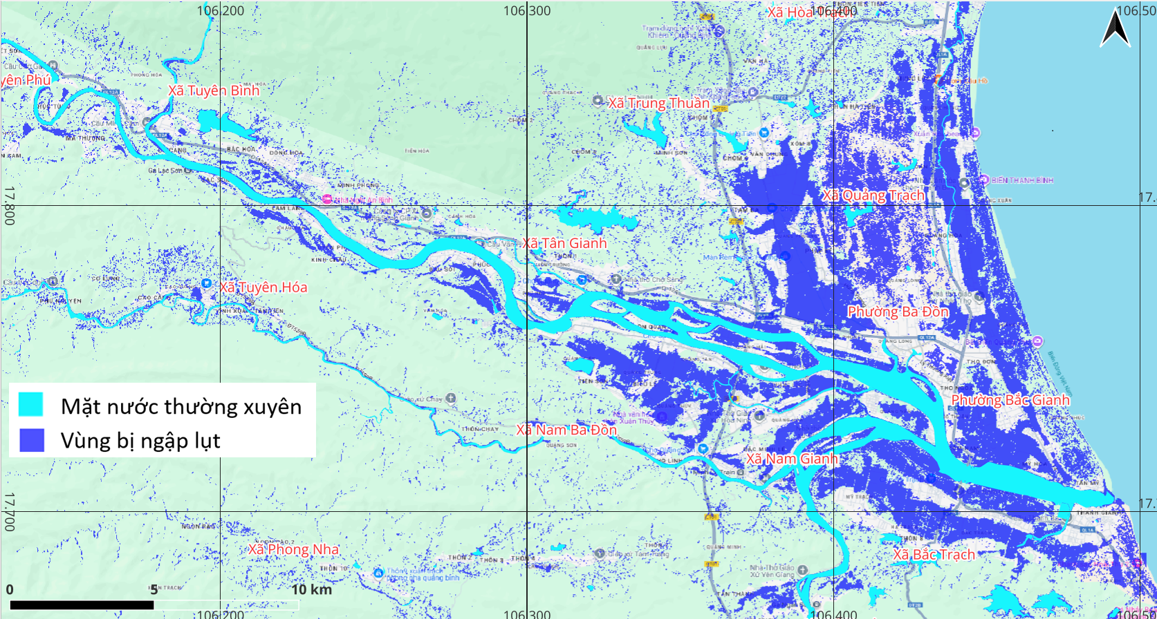
Figure 3. The downstream of the Gianh River is severely flooded. The communes/wards of Quảng Trạch, Nam Gianh, Ba Đồn, Bắc Trạch, Ba Đồn, and Bắc Gianh (Quảng Trị Province) are extensively inundated. Tuyên Hóa Commune and several areas in the midstream section of the Gianh River are also affected.
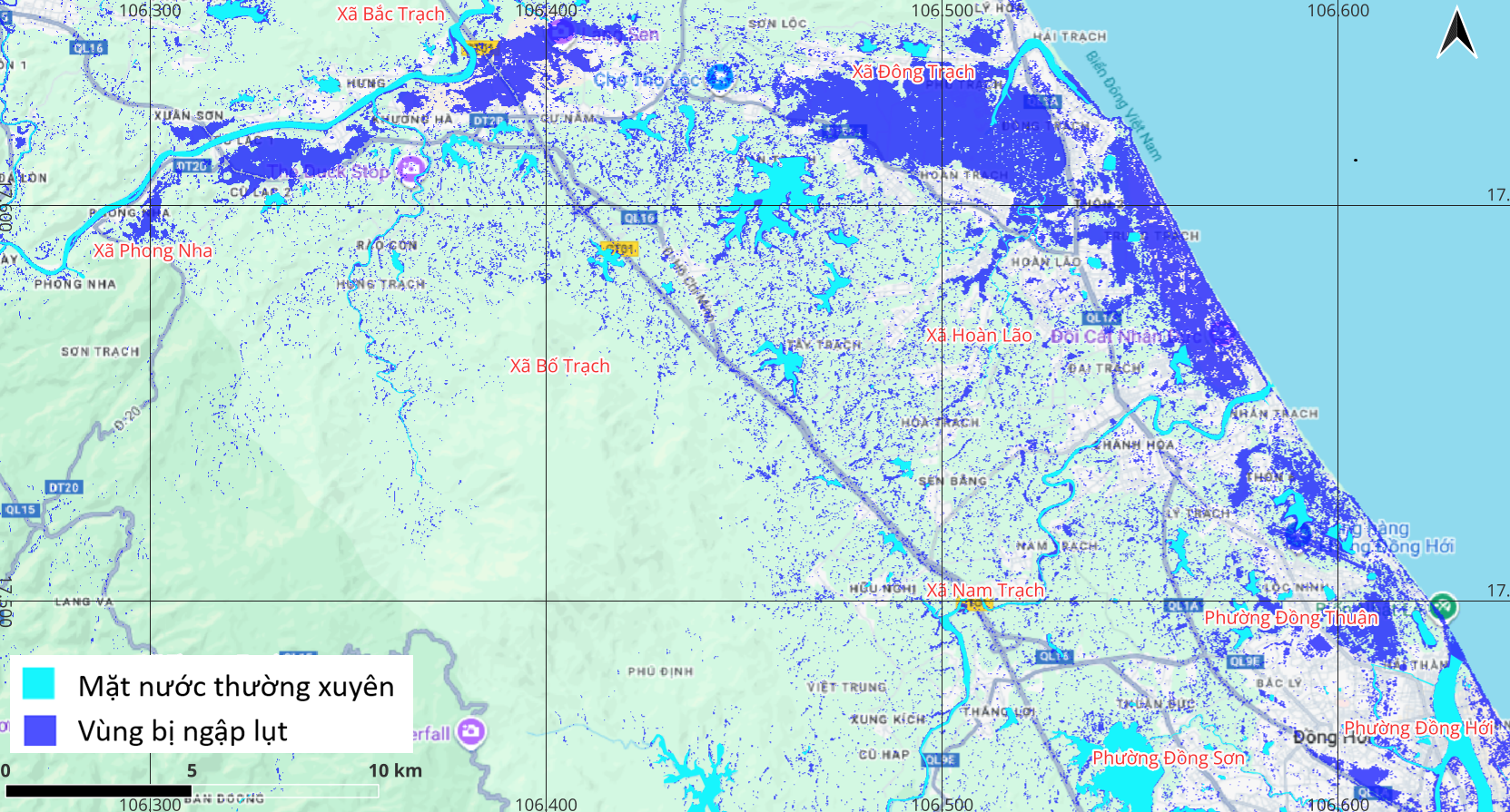
Figure 4. Đông Trạch and Hòa Lão communes, and Đồng Thuận ward (Quảng Trị Province) are currently inundated.
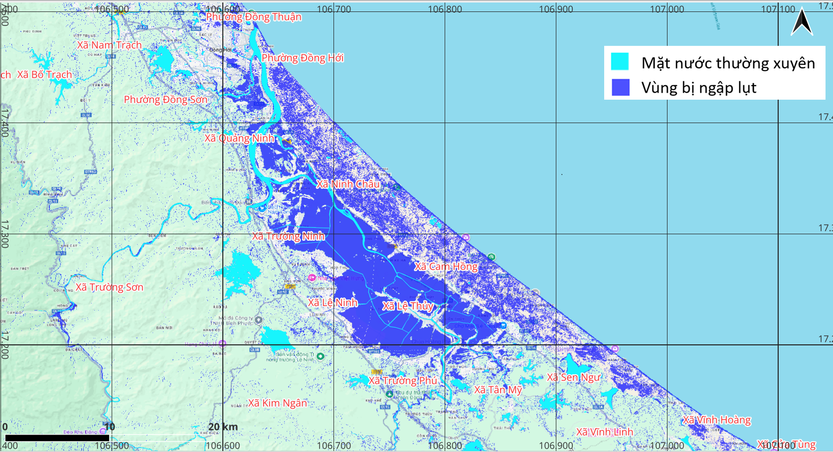
Figure 5. Nhật Lệ and Kiến Giang river basins are severely flooded. The communes/wards of Đồng Hới, Quảng Ninh, Ninh Châu, Trường Ninh, Lệ Ninh, Lệ Thủy, and Cam Hồng are among the most extensively affected localities.
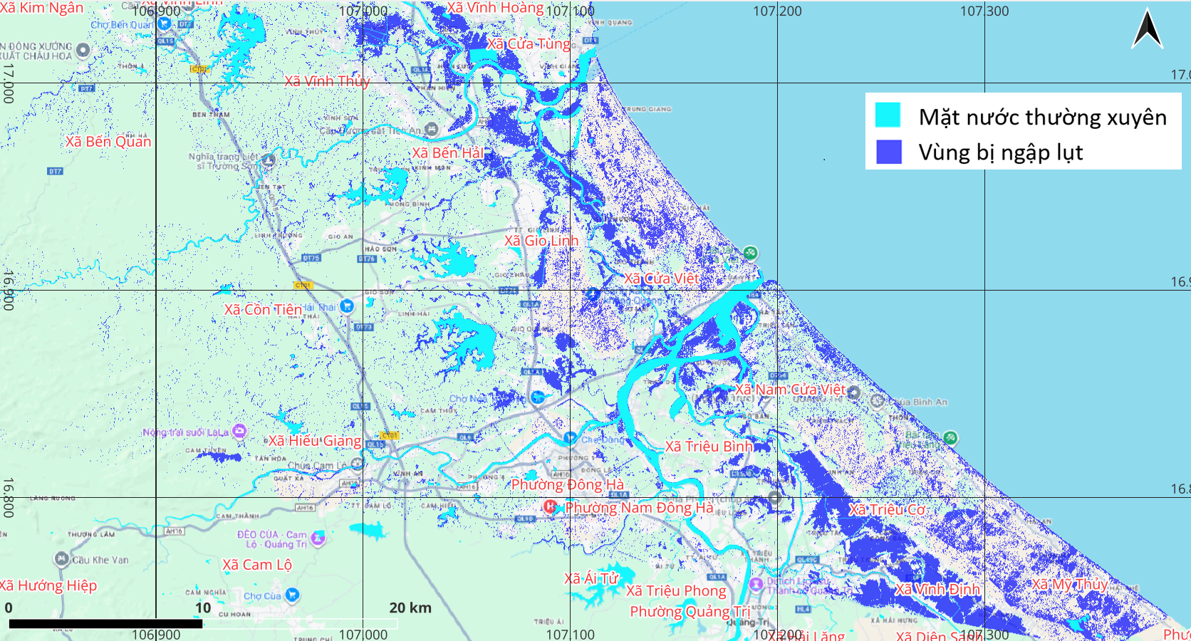
Figure 6. Bến Hải River basin is widely inundated. Flooding in the Thạch Hãn River basin is relatively limited, except for the areas of Triệu Cơ and Vĩnh Định communes.
Due to the characteristics of SAR data acquisition, certain surface features may be misclassified as flooded areas (e.g., terrain shadowing in mountainous regions, bare land, dry sand). In addition, extracting information on flooded residential areas from SAR imagery remains a significant technical challenge.
Flood Evolution and Future Outlook
Source: VEGACOSMOS