Lưu trữ danh mục: News
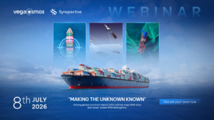
Illegal Fishing and Dark Vessel Detection Webinar: Vegacosmos × Synspective
On July 8, 2026, Vegacosmos and Synspective will co-host a technical webinar — Making the [...]
Th6
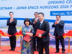
Vietnam – Japan Space Horizons 2026 Forum: VEGACOSMOS Strengths Technology Collaboration in the New Space Era
On March 13, 2026, at the Vietnam National Space Center (VNSC) in the Hoa Lac [...]
Th3
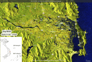
Satellite-Based Updates on Flooding in Central Vietnam, afternoon of November 04, 2025
Flooding in Central Vietnam is showing signs of receding after many days under the influence [...]
Th11
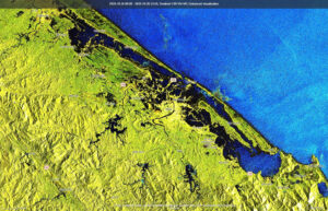
Sentinel-1–Based Flood Monitoring in Central Vietnam from late October to November 03, 2025
Flooding in Central Vietnam from mid-October to early November 2025 was complex, prolonged, and caused [...]
Th11
Sentinel-1–Based Flood Monitoring in Southern Hà Tĩnh and Quảng Trị, November 02, 2025
Flooding in Central Vietnam has become a primary concern as provinces from Hà Tĩnh to [...]
Th11

Thailand Space Expo 2025: VEGACOSMOS Strengthens Vietnam’s Geospatial Excellence
From October 16–18, 2025, at ICONSIAM, Bangkok, VEGACOSMOS, a member of VEGASTAR Technology Group, officially [...]
Th10
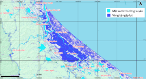
Final Update: Flood Evolution in the Cầu and Thương River Basins after Tropical Storm No.11 (Matmo)
After being affected by Tropical Storm No. 11 – Matmo, many areas along the Cầu [...]
Th10
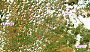
Updated Flood Monitoring at Cầu and Thương River Basins on October 14, 2025
After Tropical Storm No. 11 – Matmo weakened and moved inland, its residual circulation continued [...]
Th10
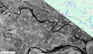
Satellite-Based Assessment of Flood Conditions Along Thương River After Typhoon Matmo
Typhoon No. 11 (Matmo) and the subsequent heavy rainfall triggered severe flooding beginning on October [...]
Th10

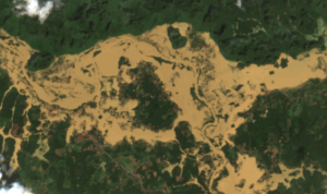
Satellite-Based Assessment of Flood Evolution along Cầu River through Bắc Ninh Province during Typhoon Matmo
Typhoon No. 11 (Matmo) and the post-typhoon rainfall and flooding caused severe inundation across multiple [...]
Th10