Flooding in Central Vietnam is showing signs of receding after many days under the influence of prolonged heavy rainfall. A Sentinel-1 radar satellite image from the European Space Agency (ESA), acquired at 17:55 on 04 November 2025, indicates that most low-lying plains and river basins from Huế to Quy Nhơn have experienced a significant reduction in flood extent compared to earlier in the week. However, Quảng Trị and Thừa Thiên Huế remain severely inundated, reflecting the complexity of flood dynamics and the influence of downstream river topography.
Regular updates of flood information derived from satellite imagery provide objective, accurate, and continuous data, supporting authorities in risk assessment, emergency response coordination, and proactive preparedness ahead of the impending landfall of Typhoon No. 13 in Central Vietnam.
Overview of flood dynamics in Central Vietnam on the afternoon of November 04, 2025
Compared to November 02 & 03, flood conditions across most provinces in Central Vietnam have improved markedly. Sentinel-1 data indicate that the majority of river basins in Quảng Nam, Quảng Ngãi, Bình Định, and Phú Yên have seen a clear reduction in inundation extent. Floodwaters have receded rapidly in low-lying plains, reflecting improved flood drainage as river water levels declined and rainfall gradually decreased.
However, disparities in flood severity among provinces remain pronounced. Huế and Quảng Trị continue to be among the most heavily affected areas, while regions from Hội An to Quy Nhơn show a trend of rapid flood recession.
Area-specific Analysis
-
Quảng Trị Area
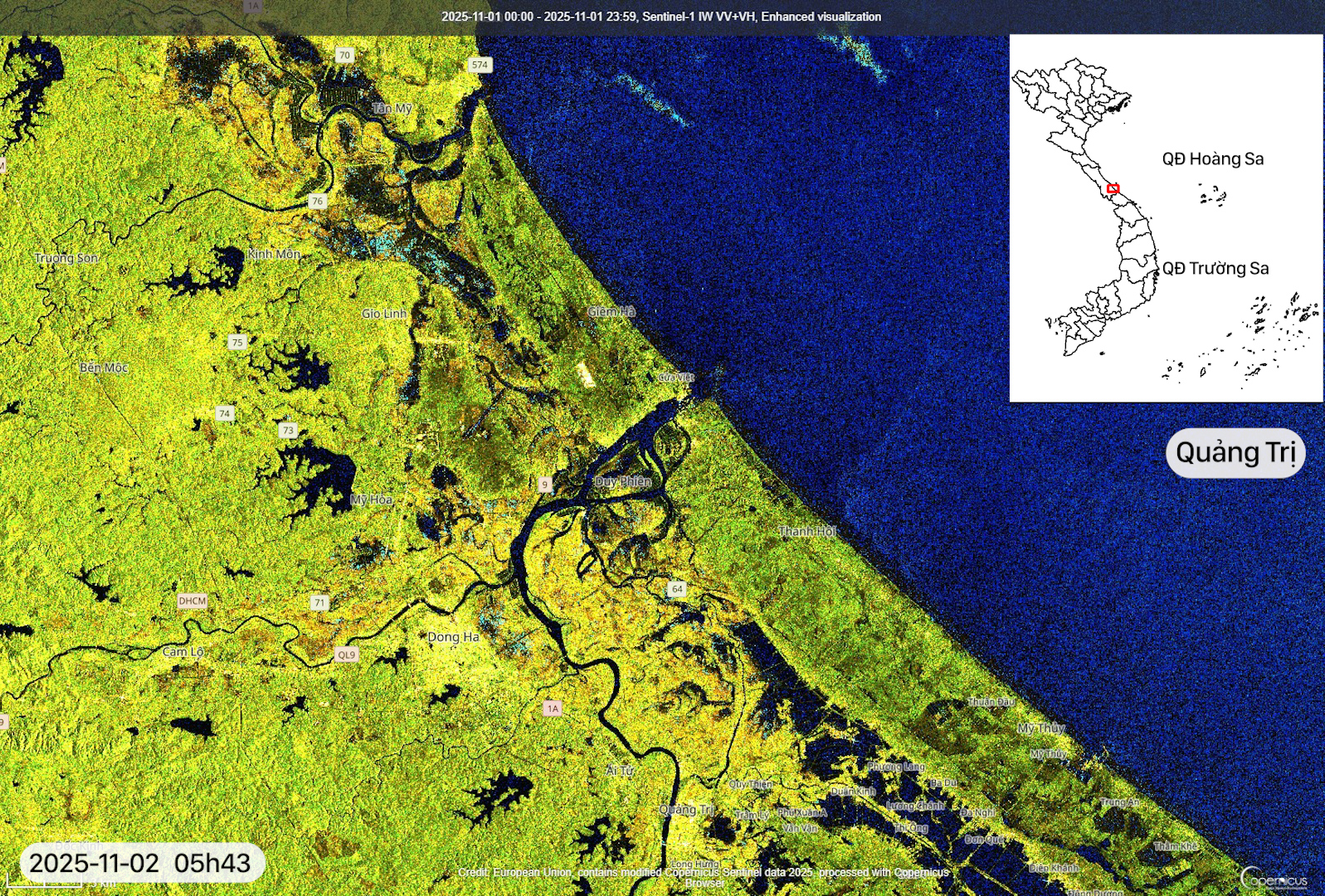
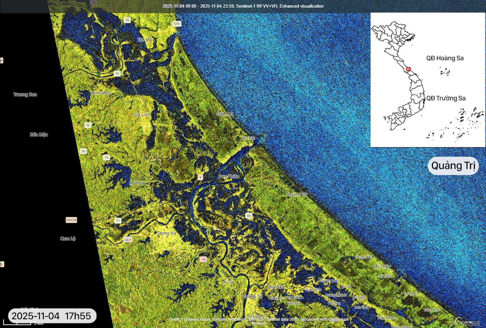
Sentinel-1 satellite imagery acquired on the afternoon of November 04 shows a sharp increase in inundated areas within the Thạch Hãn and Roòn river basins compared to the morning of November 02. Downstream areas continue to be affected by concentrated flows from upstream combined with tidal influence, causing floodwaters to expand toward the coastal plains. This area represents a major flood spot in Quảng Trị during the past week of monitoring.
-
Thừa Thiên Huế Area
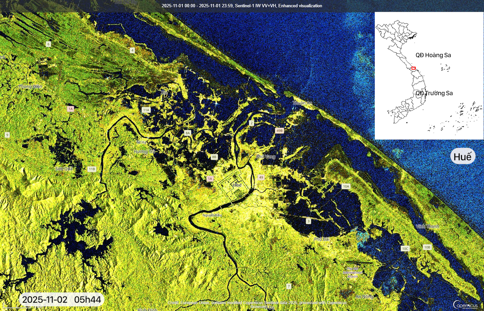
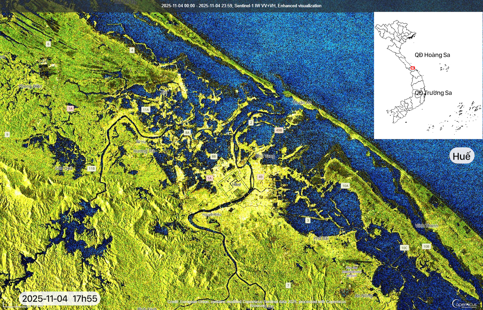
Compared to the morning of November 02, Huế area experienced deeper flooding, particularly in low-lying communes southwest of the city. Radar data captures changes in surface water extent, indicating that residual water in lakes and the downstream plain of the Hương River has not yet fully receded.
-
Hội An Area
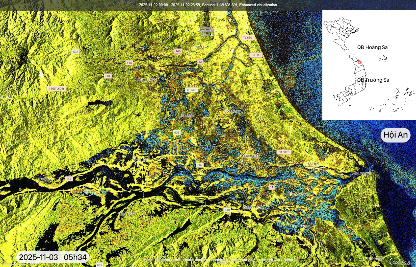
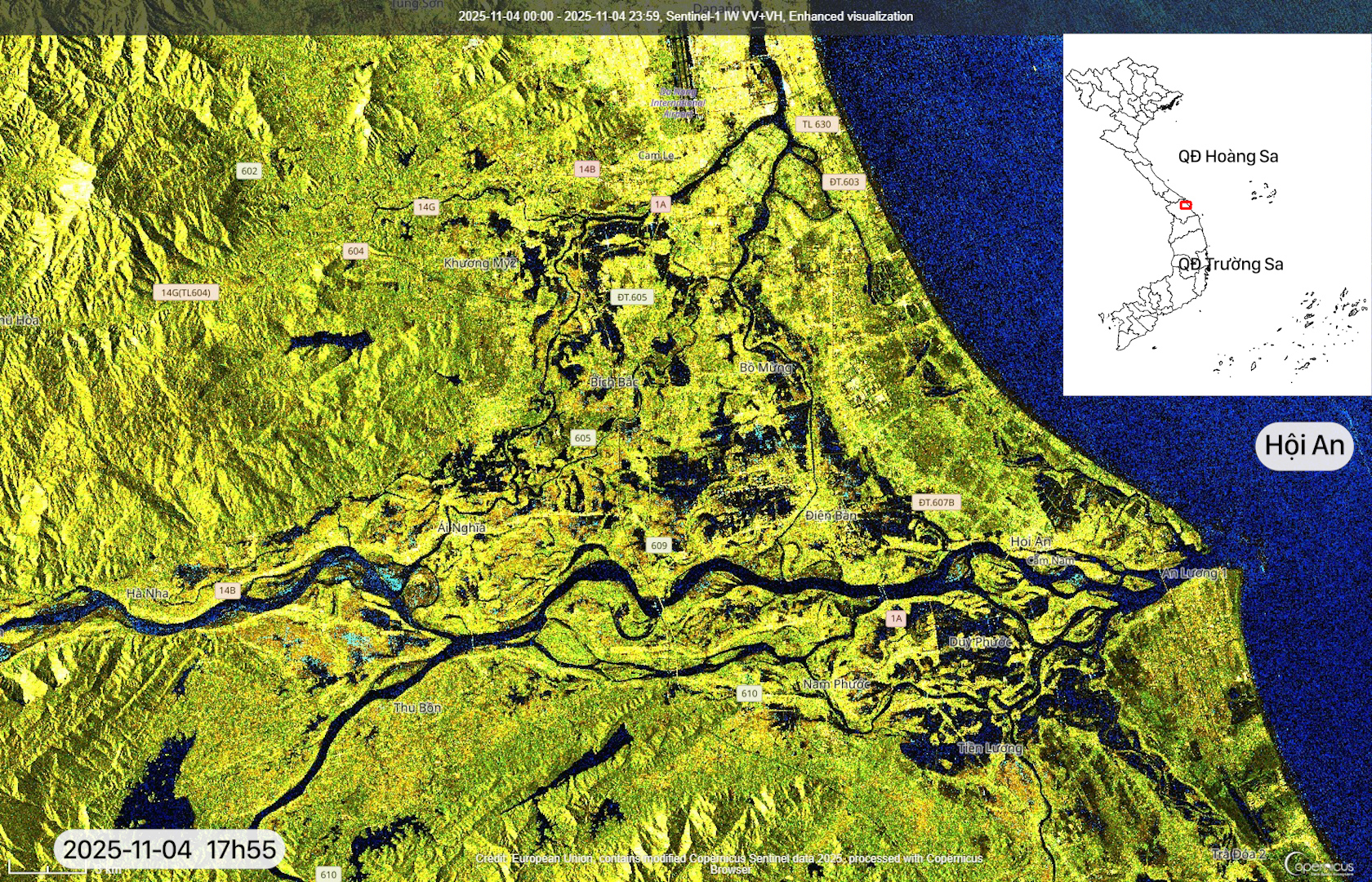
In contrast to the trend observed in Huế, Hội An area has seen a significant reduction in flooding. A comparison between images acquired on November 03 and 04 shows a clear contraction of inundated areas along riverbanks and within the old town area. However, several sections of the Trường Giang River basin still exhibit dark radar backscatter trail, indicating small patches of residual water.
-
Tam Kỳ – Trường Giang – Trà Bồng River Basins
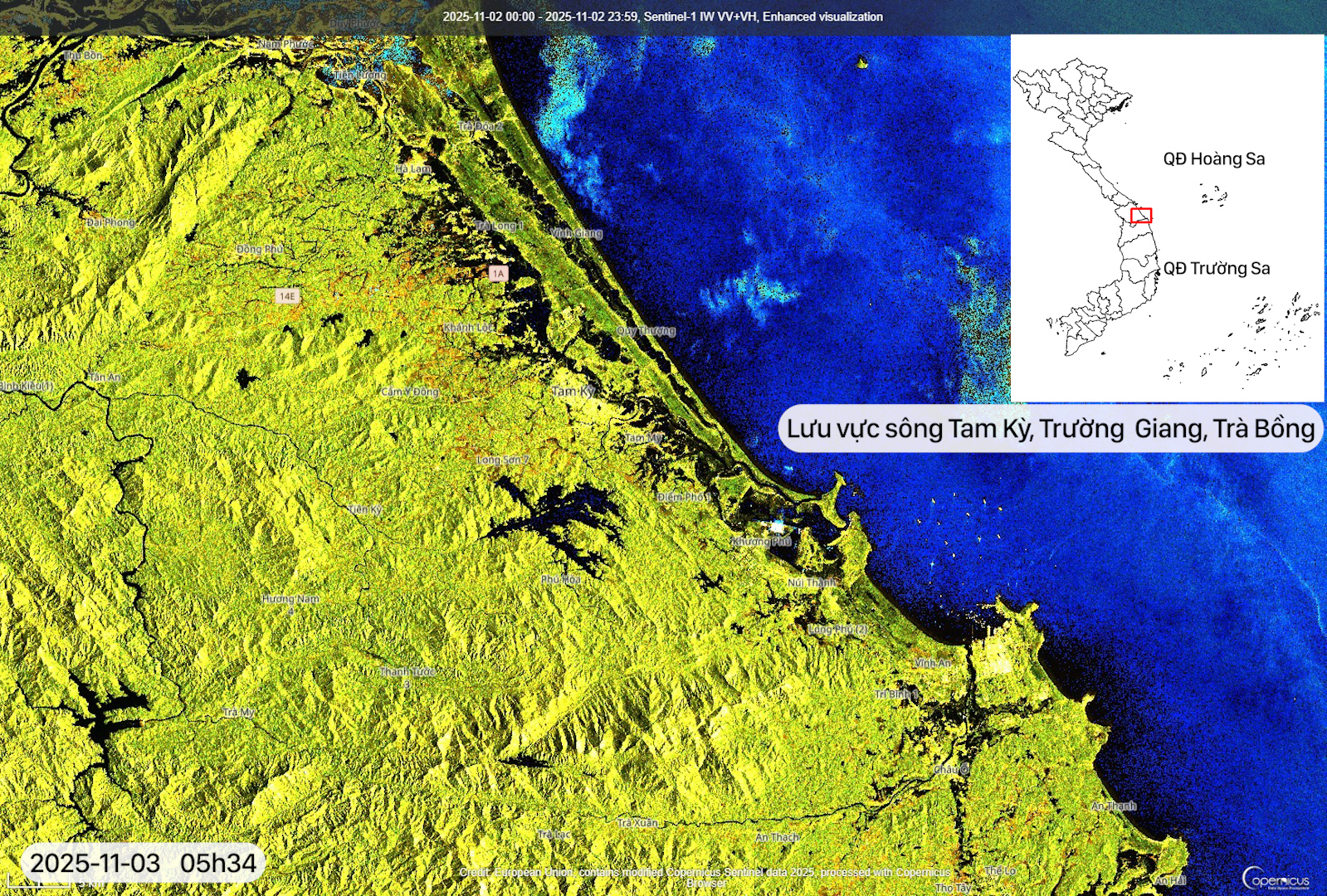
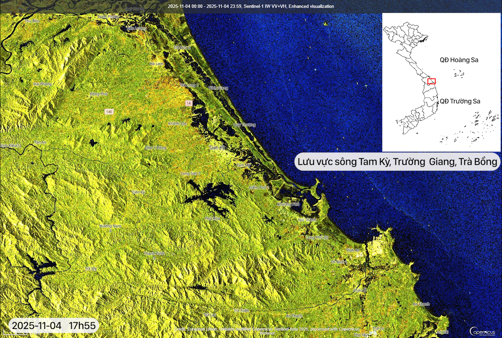
These areas show a general tendency toward rapid water recession, particularly within the Tam Kỳ and Trường Giang river basins. Radar backscatter values suggest that agricultural fields and riverine sandbars are gradually drying out.
-
Trà Khúc – Vệ – Thoa River Basins
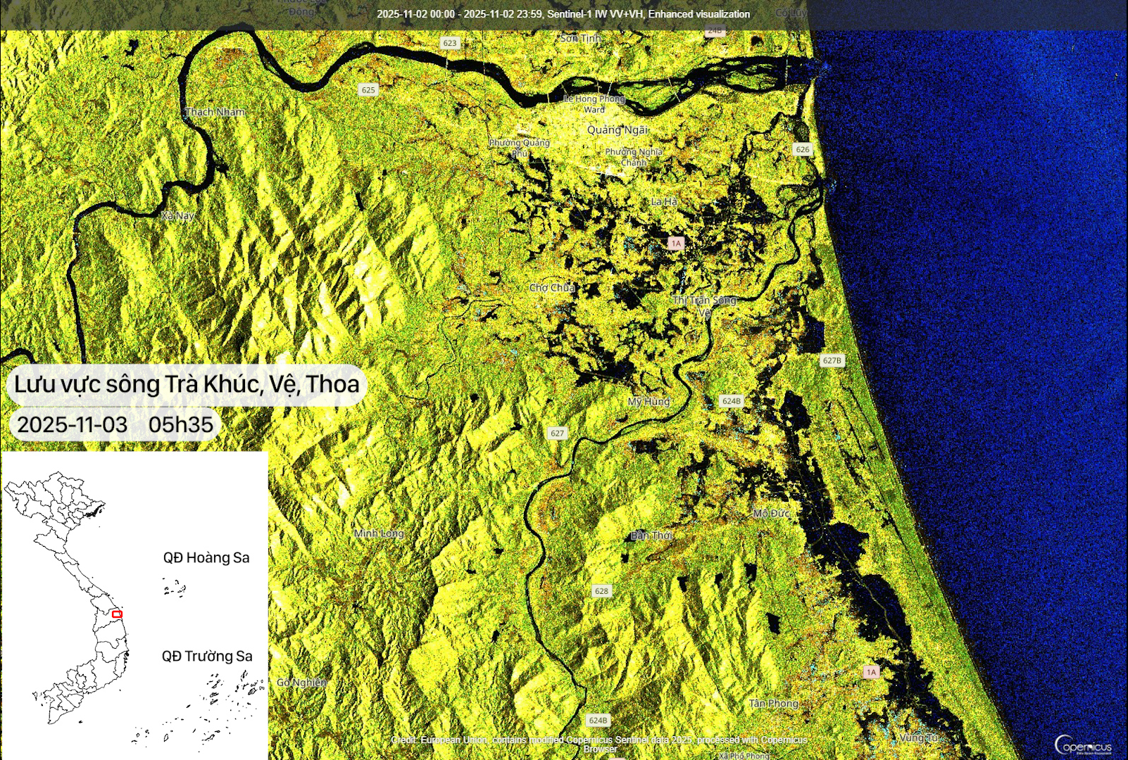
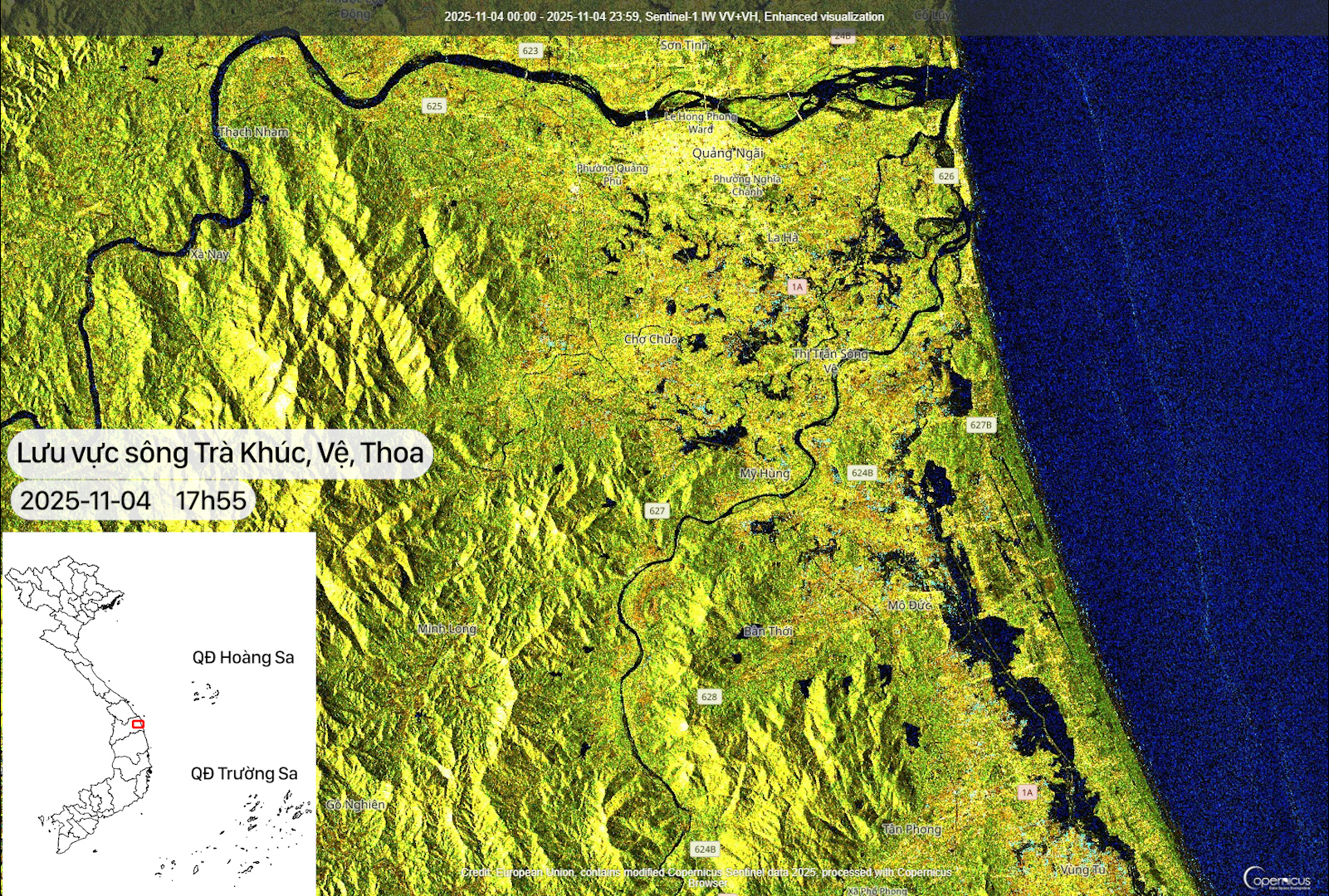
Compared to November 03, this area shows a notable decrease in inundation, especially downstream Vệ River. Floodwaters have receded quickly from riverside residential areas, reflecting increasingly stable flow conditions. Conversely, some low-lying spots near the Thoa River still retain water, but at a limited spatial extent and without significant impact.
-
Quy Nhơn Area
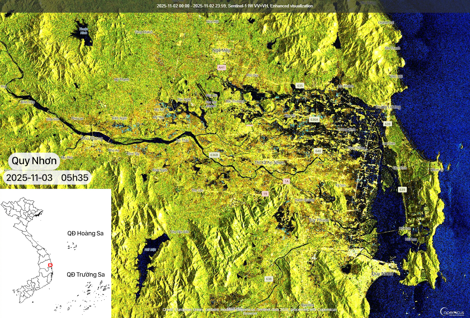
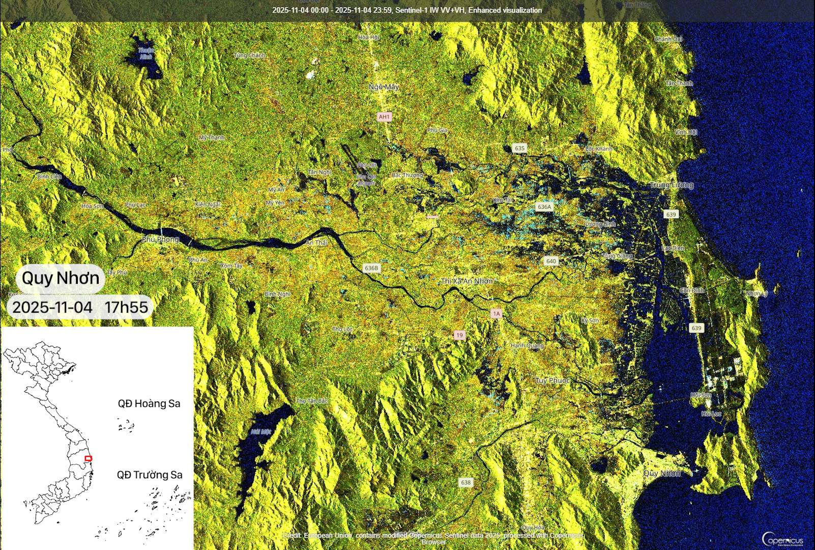
In Quy Nhơn, flood conditions have decreased substantially compared to November 03.
Analysis results indicate that most areas of Central Vietnam are entering a post-flood recovery phase; however, upcoming weather conditions still pose a high level of risk. Forecasts suggest that Typhoon No. 13 may bring heavy rainfall over the next 1–2 days. Particular attention should be given to Huế, Quảng Trị, and Quảng Bình, where saturated soils could allow flooding to reoccur rapidly, increasing the risk of landslides and deep inundation.
The application of Sentinel-1 radar imagery provides a clear advantage for continuous monitoring under persistent cloud cover, enabling authorities to proactively assess risk levels and implement timely responses.
Conclusion
By the afternoon of November 04, 2025, flooding had receded across most of Central Vietnam, indicating a positive trend ahead of the forecast landfall of Typhoon No. 13 later in the week. Nevertheless, Huế and Quảng Trị require close monitoring due to the high likelihood of re-inundation if heavy rainfall persists.
Sentinel-1 imagery continues to demonstrate its critical role in post-disaster monitoring, damage assessment and future early warning. Continuous analytics provide a comprehensive overview of flood dynamics in Central Vietnam, contributing to improved risk management capacity and more effective post-flood recovery planning.
Source: VEGACOSMOS