Typhoon No. 11 (Matmo) and the post-typhoon rainfall and flooding caused severe inundation across multiple localities from October 7 to the afternoon of October 11, 2025. Several villages and communes along the Cầu River were isolated, and emergency overtopping prevention measures had to be implemented on certain river dike sections. Remote sensing technology supports large-area flood monitoring due to its capability to acquire imagery with extensive spatial coverage.
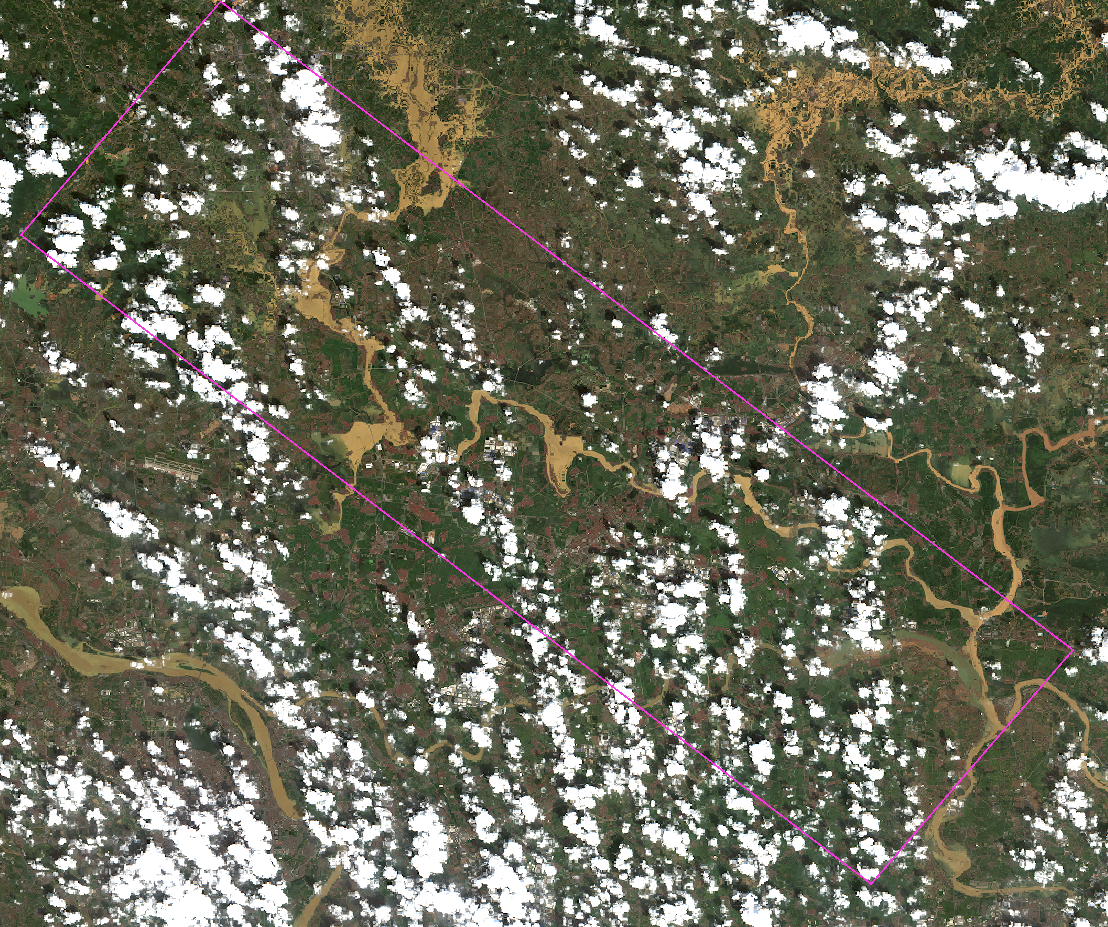
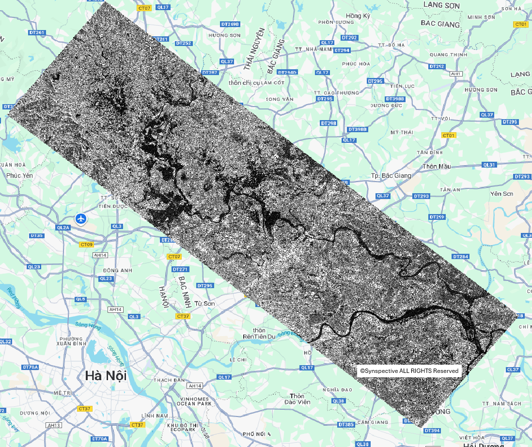
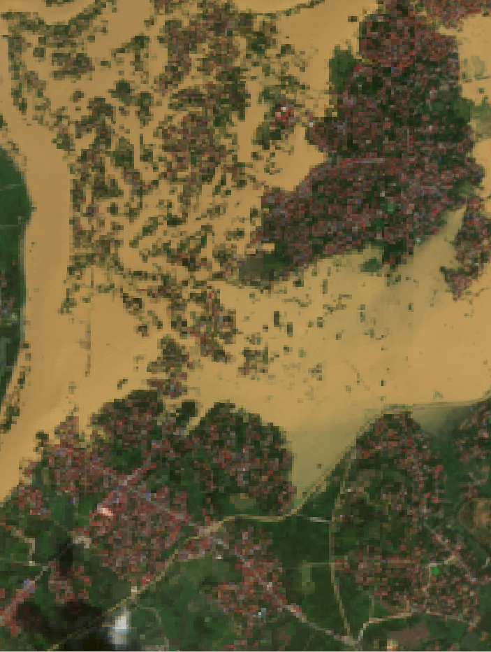
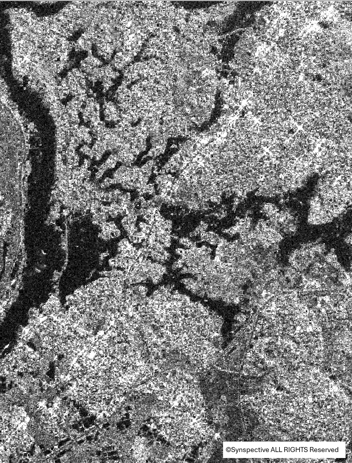
Optical Sentinel-2 imagery with 10 m spatial resolution acquired at 10:26 on October 9, 2025, and SAR imagery from the STRIX satellite (Synspective) with 3 m spatial resolution acquired at 01:38 on October 11, 2025, over the Cầu River section through Bắc Ninh Province (coverage area: 1,400 km²) provide information on flood dynamics within the respective acquisition periods.
(Reference: Application of Optical Remote Sensing Technology for Monitoring Flooding under the Influence of Typhoon Matmo – Part 1)
(1a)
(1b)
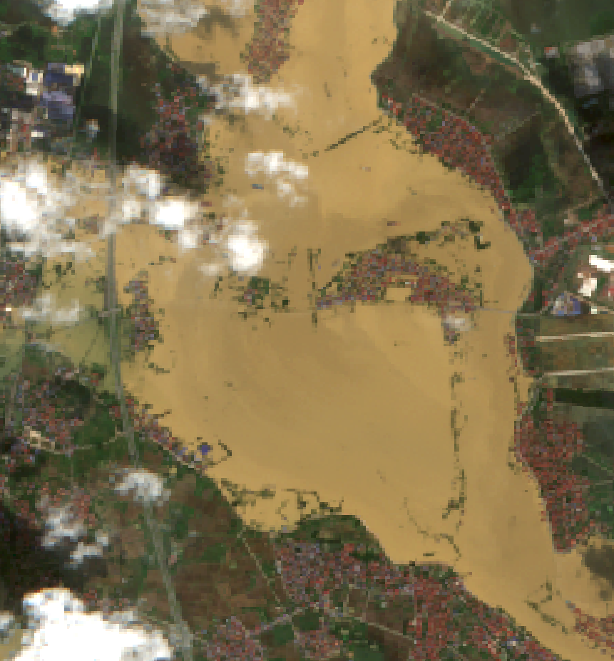
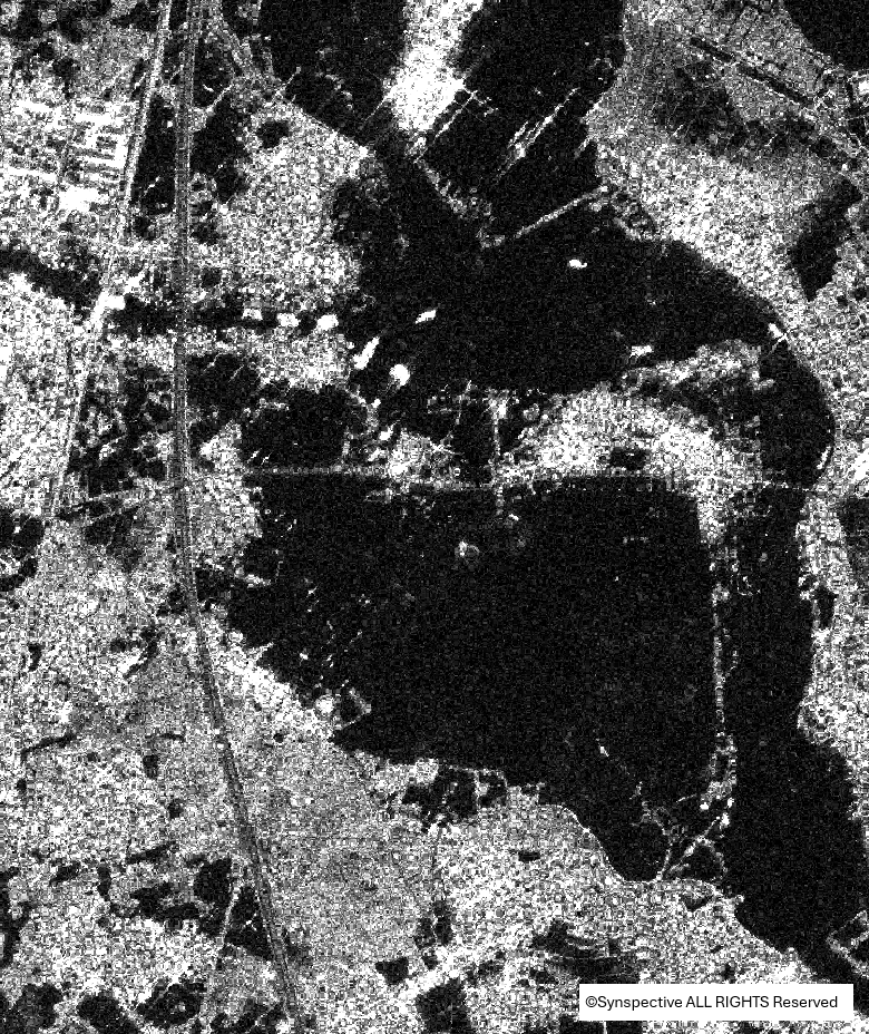
Overview of Cầu River basin through Bắc Ninh Province: (a) Sentinel-2 imagery at 10:26 on October 9, 2025, and STRIX imagery at 01:38 on October 11, 2025. (Pink boundary in Figure 1a indicates the spatial extent corresponding to the STRIX scene; basemap: Google Maps.)
 |
 |
| (2a) | (2b) |
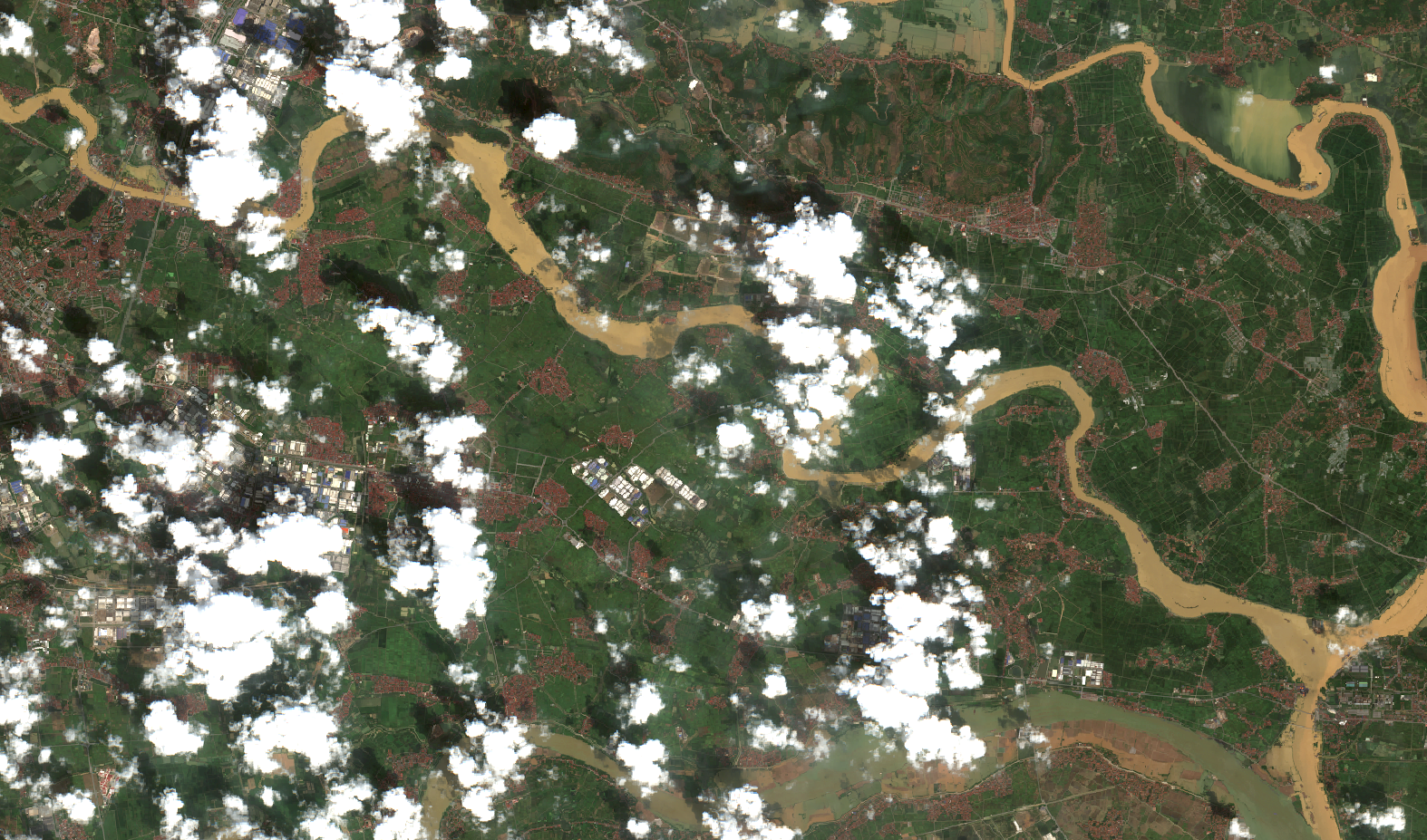
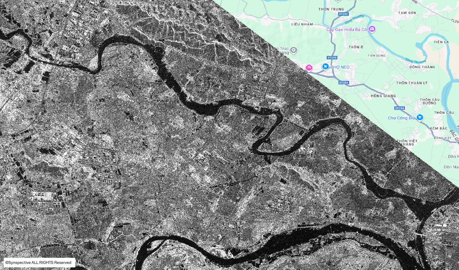
Hà Nội–Thái Nguyên Expressway (HN–TN) as observed on Sentinel-2 (a) imagery on the morning of October 9, 2025, and (b) at approximately 01:38 on October 11, 2025, on STRIX imagery. The expressway remained partially inundated.
 |
 |
| (3a) | (3b) |
Road 296 from HN–TN Expressway to An Lạc Village (3a) still inundated on the morning of October 9, 2025; (3b) no longer flooded at approximately 01:38 on October 11, 2025.
 |
 |
| (4a) | (4b) |
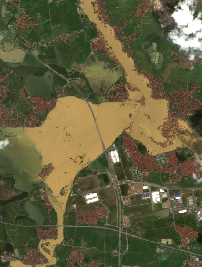
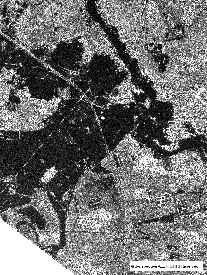
Vân Hà area (4a) isolated by floodwaters on the morning of October 9, 2025; (4b) by approximately 01:38 on October 11, 2025, only a short section of about 100 m of the access road remained lightly inundated.
 |
 |
| (5a) | (5b) |
Lạc Yên area (5a) widespread inundation on the morning of October 9, 2025; (5b) floodwaters had substantially receded by approximately 01:38 on October 11, 2025.
(6a)
(6b)
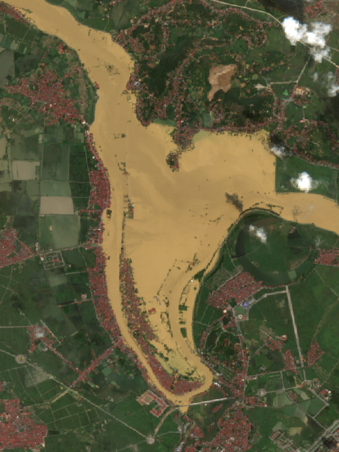
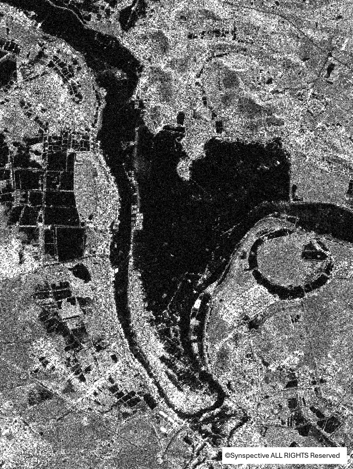
Downstream section of the Cầu River, no new inundation points were detected, and the river surface extent did not expand, indicating no dike incidents occurred and no downstream water level rise was observed between (6a) the morning of October 9, 2025, and (6b) approximately 01:38 on October 11, 2025 (basemap: Google Maps).
Based on Sentinel-2 and STRIX imagery acquired at two time points—October 9, 2025 (morning) and approximately 01:38 on October 11, 2025—the Cầu River floodwaters were observed to have receded, with no dike failures or new inundation areas detected downstream. The integration of optical and SAR satellite data enables frequent, wide-area flood monitoring, thereby providing a comprehensive overview of flood disaster dynamics.
Source: VEGACOSMOS