Flooding in Central Vietnam from mid-October to early November 2025 was complex, prolonged, and caused severe impacts across many coastal provinces. The Sentinel-1 radar satellite system operated by the European Space Agency (ESA) captured a time series of images clearly depicting flood extent in Hà Tĩnh, Quảng Bình, Huế, Hội An, Quy Nhơn, and major river basins. These data enable the identification of flood expansion and recession trends, supporting rapid, objective disaster monitoring and early warning.
Overview of Flood Dynamics in Central Vietnam
During the second half of October, successive heavy rainfall events submerged large areas of the Central Vietnam coastal plains. Sentinel-1 imagery acquired from October 16 to November 03, 2025 shows spatially variable flood extents across different regions. By early November, floodwaters had receded in many areas; however, localized inundation persisted, particularly in southern Hà Tĩnh, the Gianh River basin, downstream of the Vệ River, and the Quy Nhơn area.
The 10-m resolution SAR imagery enables floodwater detection through low backscatter signals, allowing detailed analysis of temporal and basin-scale flood dynamics.
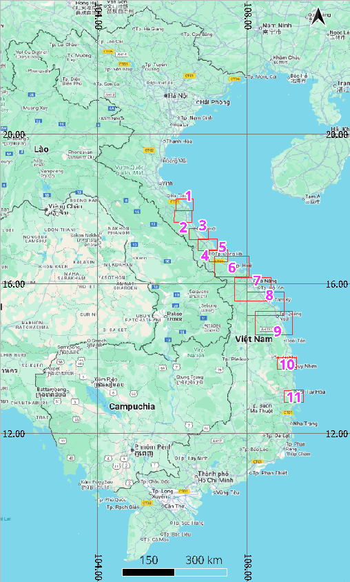
11 Flood Monitoring Areas
Flood Dynamics in Key Focus Areas
Southern Hà Tĩnh
The southern Hà Tĩnh area experienced minor flooding on October 26, followed by a reduction in inundation on October 27. Flood extent increased again on October 28, and severe inundation was observed on November 02. In Sentinel-1 false-color composite imagery, water surfaces are represented by dark blue to black tones.
Gianh River Basin – Quảng Bình
The Gianh River basin began to experience flooding on October 28, with a substantial expansion of inundated areas in the downstream reaches by November 02, 2025.
Đồng Hới & Downstream Roòn River
Đồng Hới area recorded minor flooding on October 26. Flood extent expanded on October 28, followed by partial recession by November 02.
Downstream Roòn River experienced flooding on October 20, with inundated areas expanding through October 23. Flood extent then receded by October 27, before expanding again on October 28. Among these observation dates, October 23, corresponded to the peak flooding conditions.
Downstream Thạch Hãn River
Downstream Thạch Hãn River basin, October 28, marked the most severe flooding. Earlier observations indicate minor inundation on October 21, followed by a significant expansion of flooded areas on October 23, and subsequent recession by October 27.
Huế & Hương – Bồ River Basin
Huế was among the most severely affected localities, with highly dynamic flood conditions. Sentinel-1 imagery indicates that on October 21, low-lying areas in Huế were already inundated, with flood expanding partially by October 23. October 27 was the most severe flooding event. By November 02, inundated areas had partially receded, although flood extent remained greater than that observed on October 23.
Hội An – Thu Bồn & Trường Giang River Basin
Along with Huế, Hội An was among the areas most severely affected by flooding. On October 16, the area showed no signs of inundation. By October 23, flooding had emerged in several low-lying areas along riverbanks and coastal zones, resulted in a widespread, severe inundation by October 28. By November 03, flood extent had decreased substantially in the downstream of Thu Bồn River, while inundation expanded within the Trường Giang River basin.
Tam Kỳ – Trường Giang – Trà Bồng River Basin
In the Tam Kỳ, Trường Giang, and Trà Bồng river basins, minor flooding was observed on October 23, followed by a significant expansion of inundated areas by October 28. On November 03, flood extent increased slightly further.
Tam Kỳ – Trà Bồng – Trà Khúc – Vệ River Basin
Within the Trà Khúc, Vệ, and Thoa river basins, minor flooding was recorded on October 23. Flood extent increased markedly on October 28, concentrating primarily in the plains. By November 03, severe flooding was observed in the lower Vệ River, while inundation had receded in the lower Thoa River.
Quy Nhơn Area
Since mid-October, November 03 represented the peak flooding event in the Quy Nhơn area. Earlier, on October 23, flooding was limited to estuarine and coastal zones; by October 28, inundation had expanded across the plains along river branches.
Phú Yên Province
Phú Yên Province was also affected by the heavy rainfall–induced flooding. On October 23, the area was largely unaffected; by October 28, inundation had expanded widely across the plains. By November 03, floodwaters had receded from most of the affected areas.
Trend analysis and driving factors
Flood conditions during this period were driven by prolonged heavy rainfall, steep topography, and dense river networks. Storm surges coinciding with intense rainfall slowed drainage, especially in downstream and low-lying areas. Sentinel-1 data indicate that flood extent fluctuated in response to rainfall–tidal cycles, with Huế and Quảng Bình experiencing the most pronounced impacts.
When integrated with rainfall data, topographic information, and hydrological station water-level observations, satellite-based flood monitoring models can accurately identify flood peak timing, areas of prolonged water retention, and the risk of re-inundation should Typhoon No. 13 continue to bring heavy rainfall in the coming week.
Conclusion
Analysis of Sentinel-1 imagery from mid-October to November 03, 2025 indicates an overall decreasing flood trend in Central Vietnam, though localized inundation remains in several low-lying areas. Southern Hà Tĩnh, the Gianh River basin, Huế, Hội An, and Quy Nhơn require close monitoring in the coming days, particularly as Typhoon No. 13 is forecast to make landfall toward the end of the week.
The use of Sentinel-1 radar imagery provides a significant advantage under cloudy and rainy conditions, enabling continuous monitoring and timely decision-making by disaster management authorities.
Source: VEGACOSMOS