Typhoon No. 11 (Matmo) and the subsequent heavy rainfall triggered severe flooding beginning on October 7, significantly impacting multiple localities, including areas along the Cầu and Thương Rivers. From October 9 onward, floodwaters began to recede in several locations, and the extent of inundated areas gradually decreased within the Cầu River basin.
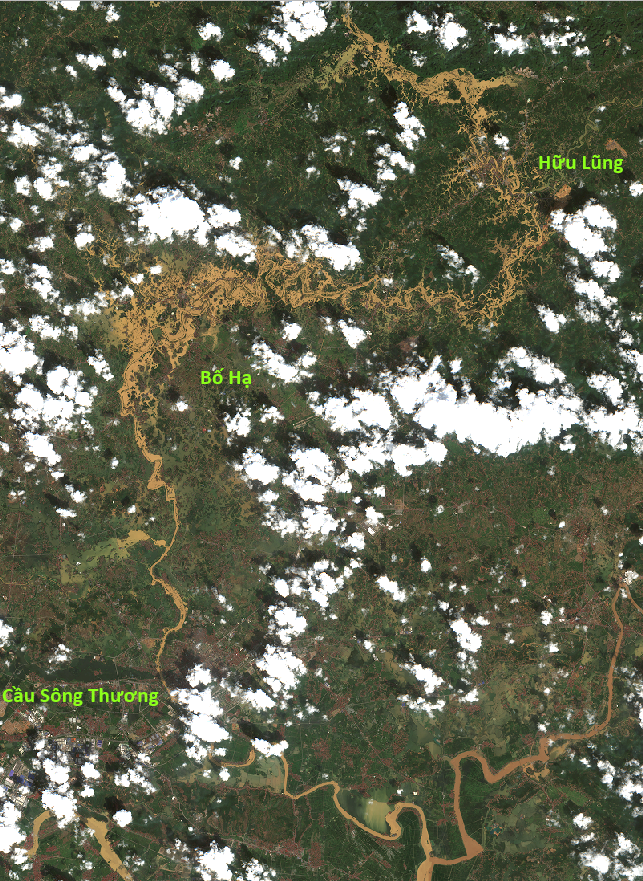
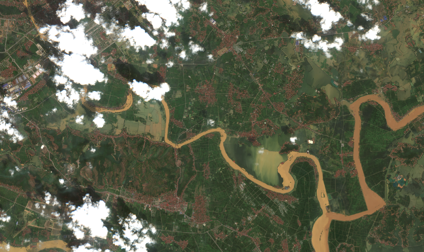
In the Thương River basin, Sentinel-2 satellite imagery acquired at 10:26 a.m. on October 9 and at 10:32 a.m. on October 11, 2025, indicates encouraging signs in the flood evolution.
 |
 |
| (1a) | (1b) |
Overview of the Thương River Basin from Sentinel-2 imagery at (1a) 10:26 a.m., October 9, 2025, and (1b) 10:32 a.m., October 11, 2025.

(2a)

(2b)
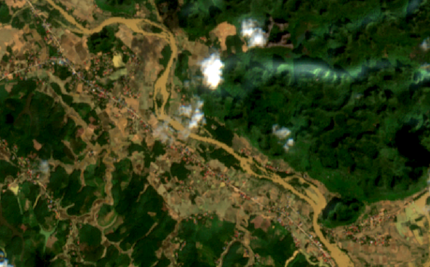
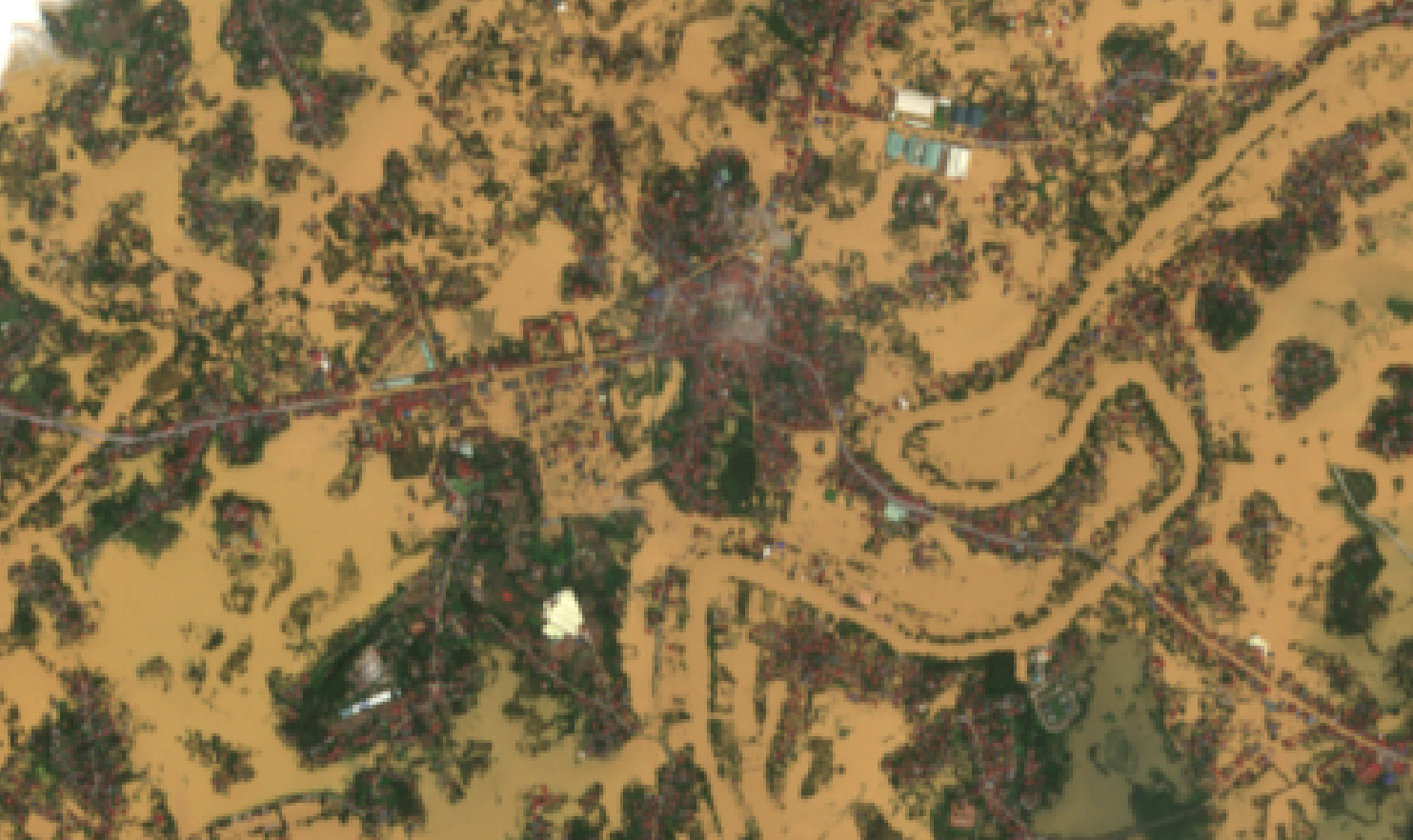
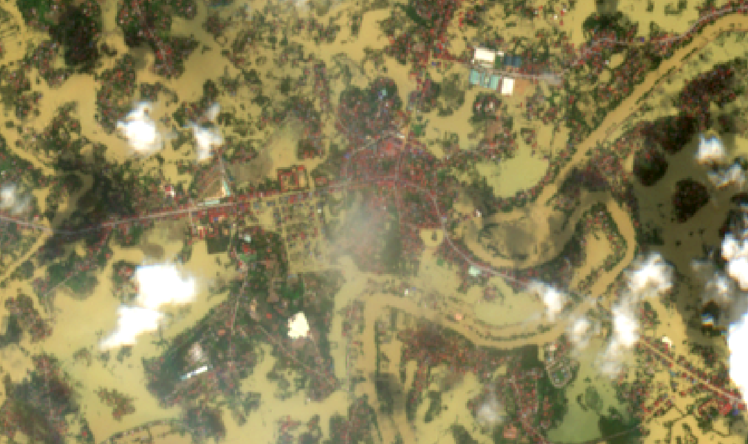
Hữu Lũng District, Lạng Sơn Province (2a) the morning of October 9, 2025, and (2b) the morning of October 11, 2025. Most areas were no longer inundated.

(3a)
(3b)
Road 242 through Tân Minh was inundated along multiple sections on the morning of October 9, 2025 (3a), but had cleared by the morning of October 11, 2025 (3b).
(4a)
(4b)
A riverside village in Nhật Tiến Commune was isolated by floodwaters on the morning of October 9, 2025 (4a), but access was restored by the morning of October 11, 2025 (4b).
(5a)
(5b)
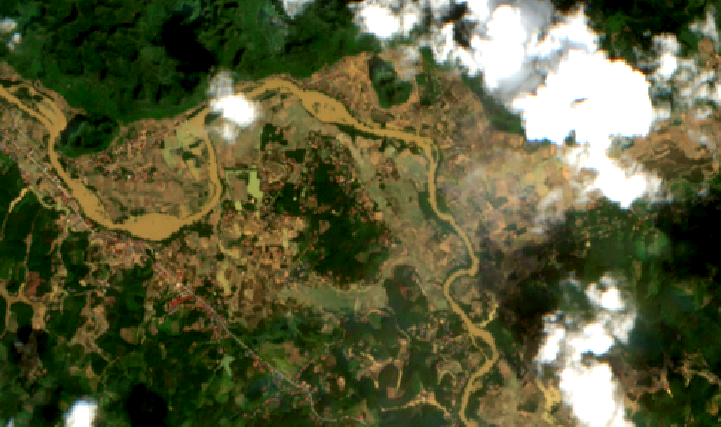
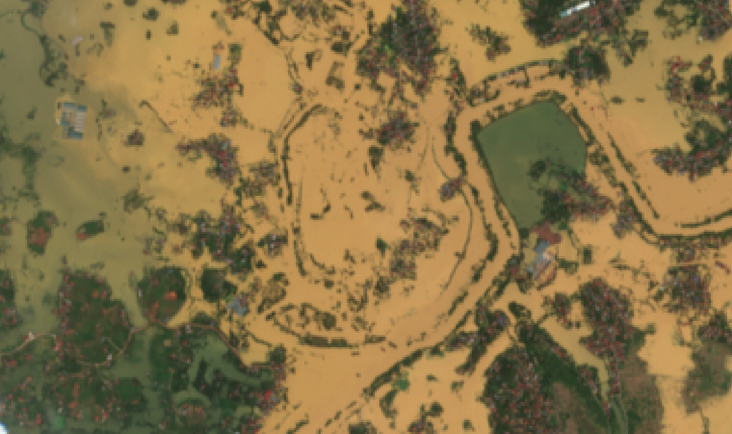
Yên Thế area (5a) the morning of October 9, 2025, and (5b) the morning of October 11, 2025. Although water levels had receded, the area remained partially inundated.
(6a)

(6b)
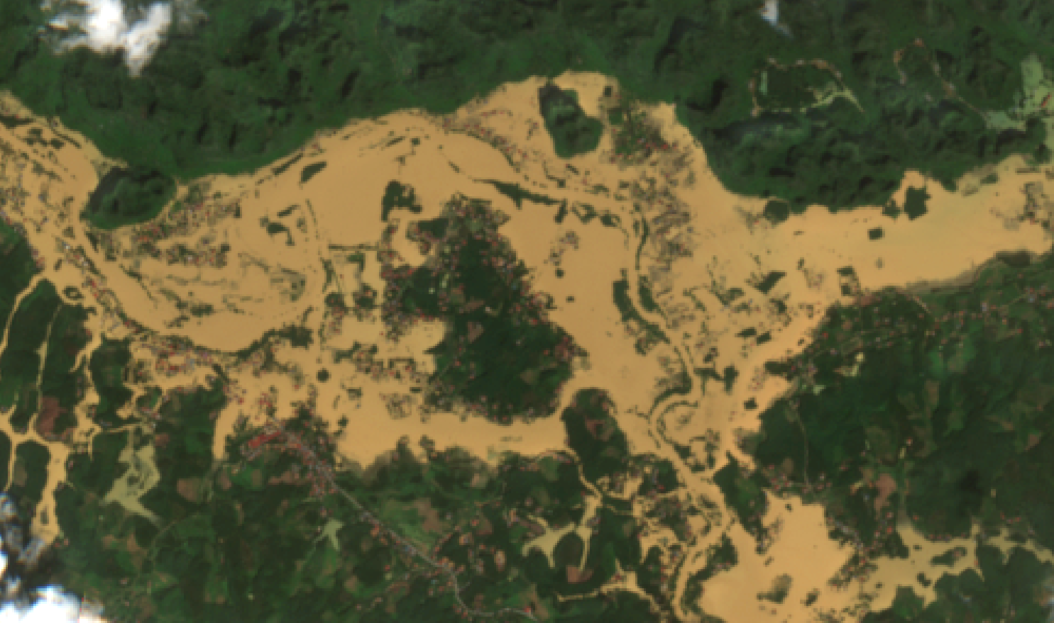
A small village in Bố Hạ Town at (6a) the morning of October 9, 2025, and (6b) the morning of October 11, 2025, remained flooded, with several villages still isolated.
(7a)

(7b)
Thương River Railway Bridge (7a) the morning of October 9, 2025, and (7b) the morning of October 11, 2025. A 300-ton freight train was positioned at mid-span from the afternoon of October 8, 2025, to increase structural load and stabilize the bridge, which has since been confirmed safe.
(8a)

(8b)
Downstream Thương River at its confluence with Thái Bình River (8a) the morning of October 9, 2025, and (8b) the morning of October 11, 2025. The river surface did not expand further, and water turbidity decreased, indicating receding floodwaters and reduced flow velocity.
Sentinel-2 imagery covering the Thương River basin shows that by the morning of October 11, 2025, flooding conditions in Lạng Sơn Province had improved significantly, with several northern areas nearly free of inundation. Downstream toward Bắc Ninh Province, flood extent had decreased compared to the morning of October 9, 2025; however, some riverside villages remained isolated. Further downstream, flow velocity had diminished and no new inundation areas were detected. Notably, the Thương River railway bridge was confirmed to be structurally secure. With its wide spatial coverage, remote sensing data provides valuable information for monitoring flood dynamics as well as other natural hazards.
Source: VEGACOSMOS