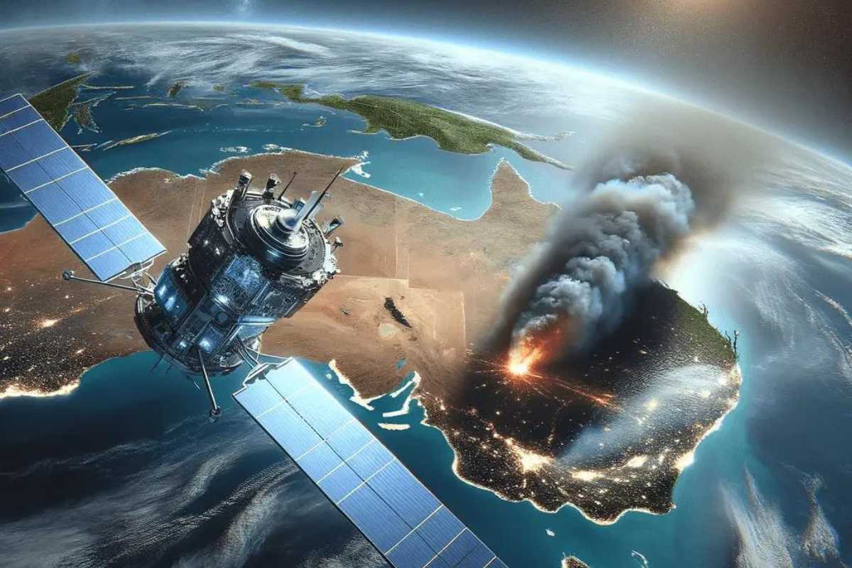
Natural disasters are occurring with growing frequency and intensity, and humanity has yet to fully prevent their impacts. Nevertheless, advances in science and technology, most notably satellite imagery, are equipping us with powerful tools to prepare for, respond to, manage, and recover from such events more effectively.
With their wide-area coverage, continuous updates, and high spatial accuracy, satellite images have become indispensable in modern disaster management and recovery: delineating affected zones, quantifying the extent of devastation, and supporting rescue operations in real time.
Benefits of using satellite imagery in disaster management and recovery
Satellite imagery has become a cornerstone of planning, response, and reconstruction after natural disasters. Earth-Observation (EO) data deliver comprehensive, timely information that enables decision-makers at every level to act swiftly and accurately. Key advantages include:
- Immediate damage assessment
Near-real-time images pinpoint the location and severity of destruction, allowing authorities to delineate affected areas and craft appropriate response plans without delay.
- Resource allocation and prioritization
EO analysis ranks impacted zones by urgency, optimizing the deployment of personnel, supplies, and financial aid so resources reach the right place at the right time.
- Enhanced coordination and information sharing
Continuously updated satellite data provide governments, rescue teams, and partner organizations with a shared operational picture, streamlining communication, coordination, and situational monitoring.
- Recovery and reconstruction monitoring
Time-series imagery tracks the progress of infrastructure repairs, highlights residual vulnerabilities, and guides reconstruction strategies to ensure a resilient and sustainable recovery.
- Flexible satellite tasking via data-sharing platforms
Ecosystems such as GEOHUB let agencies without dedicated satellites rapidly schedule new acquisitions, retrieve imagery, and perform on-demand processing. This on-the-fly tasking shortens data-delivery times and speeds up the extraction of mission-critical information.
With unmatched speed, coverage, and seamless integration with other information systems, satellite imagery has become, and will remain, an indispensable pillar of comprehensive disaster-risk management strategies.
Challenges in deploying satellite imagery for disaster management and recovery
Although satellite imagery holds great promise for disaster response and reconstruction, several obstacles still hinder its full-scale adoption:
- Technical limitations
Many current datasets lack sufficient spatial resolution to detect small-scale infrastructure damage, while pervasive cloud cover, especially in humid climates, can obscure entire scenes and render analysis nearly impossible.
- Financial and logistical constraints
The costs of tasking satellites, purchasing commercial imagery, and maintaining specialized computing and storage infrastructure remain high, often exceeding the budgets of disaster-prone localities. Added to this are unresolved issues of broadband connectivity and data security.
- Human-resource shortages
Effective exploitation of Earth-observation data requires specialists skilled in calibration, classification, and advanced modeling. Such expertise is scarce and unevenly distributed, creating a persistent talent gap.
Recognizing these three challenge areas is essential for authorities to devise appropriate investment strategies, strengthen workforce training, and craft sustainable financing mechanisms, thereby unlocking the full potential of satellite technology in disaster management and recovery.
How satellite imagery supports emergency response
Forecasting and prevention
Satellite imagery is a cornerstone of emergency response, particularly for disaster forecasting and prevention. Multispectral data reveal soil moisture, texture, and composition, allowing analysts to gauge infiltration capacity and surface runoff, critical determinants of flood risk. When combined with three-dimensional terrain models derived from satellite data, authorities can precisely delineate flood-prone catchments, design suitable drainage infrastructure, and plan early evacuations.
For landslide mitigation, the integration of optical and radar imagery with on-site measurements pinpoints steep slopes, zones of severe erosion, and areas of declining vegetation health—key indicators of potential slope failure. This insight enables agencies to deploy early-warning networks and reinforce vulnerable hillsides at exactly the right locations and times.
In wildfire prevention, satellite sensors track canopy density, vegetation vigor, and dead biomass (often caused by insect infestation) to generate seasonal fire-risk maps. These products guide forest managers in positioning firebreaks, installing surveillance equipment, and activating early-warning systems, ultimately reducing losses of life and forest resources.
Thanks to its wide coverage, continuous updates, and seamless integration with predictive models, remote-sensing technology is steadily enhancing the accuracy of risk scenarios, empowering authorities to act proactively and minimize damage before disasters occur.
Planning and preparedness
Even when natural disasters cannot be predicted with precision, preparedness remains a vital strategy for minimizing damage. Very high-resolution (VHR) satellite imagery, when combined with 3D terrain models, offers a comprehensive spatial perspective for designing evacuation routes, positioning response teams, and developing contingency plans. A notable example is from 2016, when Brazilian security forces utilized Maxar satellite imagery to map the entire city of Rio de Janeiro ahead of the Olympic Games. This dataset enabled them to identify public safety hotspots, areas with high mosquito density, potential security threats to VIP guests, and optimal evacuation corridors. Advanced digital surface models (DSM) also helped calculate lines of sight between key locations, ensuring effective surveillance and rapid response throughout the event.
In Vietnam’s Mekong Delta, a region regularly affected by heavy rains, upstream flooding, and sea level rise, government agencies such as the Institute of Meteorology, Hydrology and Climate Change (IMHEN), the National Remote Sensing Center (NRSC), and local authorities have collaboratively employed optical and radar satellite data (e.g., Sentinel-1, Sentinel-2, and Landsat) to monitor water levels and produce real-time flood maps.
By analyzing multi-temporal imagery, researchers identified seasonal flood patterns, high-risk residential areas, and vulnerable infrastructure. Local governments have used this information to plan evacuation routes, establish safe shelters, and pinpoint locations in need of improved drainage systems.
Furthermore, digital elevation models (DEMs) derived from satellite data allow for the simulation of future flood scenarios under the influence of climate change. These simulations provide crucial input for sustainable urban planning, agricultural zoning, and water management system design across the region.
Emergency response
When a natural disaster or emergency event unfolds, the top priority is to rapidly acquire and transmit high-resolution satellite imagery from the affected area. This near-real-time data enables relief teams to map damage, assess the impact on critical infrastructure, and accurately determine the personnel and resources required at each location. By analyzing pre- and post-event imagery, emergency coordinators can swiftly identify obstructed evacuation routes, designate safe helicopter landing zones, position temporary medical facilities or supply depots, and estimate the number of residents in need of urgent evacuation.
Throughout the response phase, satellite data also plays a vital role in real-time monitoring of evolving hazards, such as wildfires, chemical spills, or disruptions to water supply, allowing responders to adapt their strategies promptly. Comparing current imagery with historical archives not only quantifies the scale of destruction but also highlights hotspots where the situation may escalate, enabling decision-makers to prioritize interventions and maximize the efficiency of relief operations, ultimately reducing harm to affected communities.
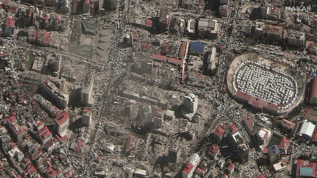
Post-disaster damage assessment and reconstruction
In the aftermath of a disaster, conducting on-site surveys across vast affected areas can take days or even weeks. High-resolution satellite imagery offers a faster, more efficient alternative, allowing analysts to delineate impacted zones, quantify damage, and generate detailed damage maps without the need for immediate ground access. This approach proves especially valuable when transportation infrastructure is compromised, risks remain present in the area, or emergency teams must focus on life-saving operations.
At the end of 2020, several central provinces in Vietnam, such as Quang Tri, Thua Thien Hue, Quang Nam, and Quang Binh, were devastated by historic flooding that caused severe losses in both human life and property. Prolonged rainfall and widespread road closures made initial field assessments nearly impossible. In response, the National Remote Sensing Center (NRSC), along with international partners such as UNOSAT and JAXA, utilized Sentinel-1 radar satellite imagery, which can penetrate cloud cover and operate day and night, to map flood extents. By comparing pre- and post-flood imagery, experts identified inundated areas, assessed damage to populated zones and infrastructure, and supported disaster management authorities in prioritizing aid distribution and identifying isolated communities in need of urgent assistance.
In the recovery phase, satellite imagery continued to be instrumental in monitoring the reconstruction of transportation networks, schools, healthcare facilities, and agricultural zones. These insights enabled local governments to evaluate the effectiveness of aid programs, pinpoint areas requiring long-term intervention, and formulate adaptive flood mitigation strategies.
With its wide-area perspective and periodic updates, satellite imagery not only facilitates infrastructure recovery but also provides visual evidence of reconstruction sustainability and long-term environmental impacts. This critical data helps stakeholders refine planning efforts, ensuring that affected communities regain stability and build greater resilience against future disasters.
The future of satellite imagery in disaster management and recovery
In recent years, satellite imagery has evolved from a reference data source into the backbone of disaster-damage assessment systems. Ever-higher spatial resolution and denser revisit rates now allow authorities to grasp the scale of impacts on infrastructure and populations with unprecedented speed. The current trajectory extends beyond improvements in optical and radar sensors; it emphasizes the full integration of artificial intelligence (AI) and machine learning (ML) across the processing chain.
By fusing satellite images with on-site IoT sensor readings and real-time social-media feeds, AI-driven analytics can automatically detect damage patterns, estimate severity, and prioritize areas for relief, tasks that human analysts cannot complete quickly enough by manual means. Deep-learning algorithms process terabytes of data within minutes, supporting near-instant decisions and dramatically narrowing the critical “golden gap” between a disaster’s onset and the delivery of aid.
This convergence of next-generation satellites, big-data analytics, and AI promises to usher in an era of disaster management distinguished by higher accuracy, greater speed, and enhanced predictive power.