Currently, the world has approximately 1,374,000 kilometers of railway lines and over 80 million kilometers of power lines, much of which traverses forested areas, rugged terrains, or remote regions. Monitoring and maintaining these infrastructure corridors manually is a costly and challenging task. This is where geospatial data proves its value—ranging from satellite imagery and remote sensing data to change detection algorithms, all of which support efficient and cost-effective remote monitoring and management.
But first, let’s explore why vegetation management and infrastructure maintenance are so critically important.
What is vegetation management?
Vegetation management is the deliberate process of controlling the growth of plant species that may obstruct or pose a threat to the safety and operational stability of infrastructure systems. The primary goal of this activity is to prevent uncontrolled growth of trees, weeds, or other vegetation, especially in sensitive areas such as utility corridors, railway tracks, pipelines, or other critical infrastructure sites. By maintaining a balance between natural ecosystems and technical requirements, vegetation management helps mitigate the risk of fire, equipment failure, and potential disruptions in infrastructure operations.
The need for vegetation impact assessment
In industries such as energy, rail transport, and telecommunications, uncontrolled vegetation growth poses a constant threat to the safety and operational stability of infrastructure systems. In the United States, California alone recorded over 9,900 wildfires in 2020, burning more than 4.3 million acres and causing an estimated $19 billion in damages. A significant portion of these fires, around 60% of those linked to human or technical causes, stemmed from vegetation growing too close to power lines, alongside natural causes such as lightning. In Europe, severe storms often cause trees to fall onto railway tracks, leading to service disruptions and creating serious public safety risks.
These real-world scenarios highlight the critical need for proactive vegetation assessment and management to ensure system reliability and minimize risks to both human life and the environment.
In Vietnam, the demand for vegetation assessment is becoming increasingly urgent, particularly amid the rapid development of power grids, urban railways, and telecommunications networks. With its diverse topography and humid tropical climate, vegetation in Vietnam grows rapidly, heightening the risk of fires, obstructing transmission lines, or damaging equipment during extreme weather events. As a result, the integration of geospatial data and remote monitoring technologies into vegetation assessment and management has become an essential solution for ensuring infrastructure safety and promoting sustainable development.
The importance of vegetation management
Effective vegetation management goes far beyond aesthetics. While maintaining a clean and orderly landscape has its visual and practical benefits, the core objective of vegetation control is to ensure the safety and operational stability of critical infrastructure systems, particularly power transmission lines, railway networks, and industrial zones. When vegetation is not properly managed, it can lead to service interruptions, equipment damage, and serious hazards such as fires or explosions.
For example, overgrown trees can come into contact with power lines, potentially causing power outages, or in more severe cases, triggering widespread wildfires. In California, USA, several devastating wildfires in recent years have underscored the catastrophic consequences of poor vegetation control around power infrastructure.
Therefore, regulating vegetation growth in sensitive areas is not just a matter of maintenance, it is a critical safety measure. Proper vegetation management helps safeguard infrastructure assets and protect communities that rely on electricity, transportation, and other essential services for their daily lives.
Long-Term Benefits of Vegetation Management
Reducing Fire Risks
In fire-prone regions like California, vegetation management plays a critical role in preventing and mitigating wildfires. Removing dead or dry underbrush significantly reduces the risk of large-scale fire outbreaks. Controlling tree growth near power lines also helps prevent electrical sparks that could ignite devastating blazes. This proactive approach not only protects infrastructure and property but also minimizes disaster-related damages, safeguarding both lives and the surrounding environment.
Enhancing Infrastructure Reliability
Consistent vegetation maintenance is an effective strategy to protect critical infrastructure—such as power lines, railways, substations, and telecommunication cables—from damage caused by falling branches or encroaching trees. By keeping utility corridors clear, the likelihood of service disruptions is greatly reduced, leading to fewer power outages and lower long-term maintenance costs.
Improving Community Safety
For residential areas and businesses located near essential infrastructure, effective vegetation management can make a clear difference between a safe environment and one filled with potential hazards. In addition to lowering fire and outage risks, managing trees around homes, parks, and public spaces can help prevent accidents caused by falling limbs or obstructed visibility. This not only enhances community safety but also contributes to better overall quality of life.
How vegetation management protects infrastructure
Vegetation management plays a vital role in ensuring the safety, efficiency, and long-term stability of various types of infrastructure systems:
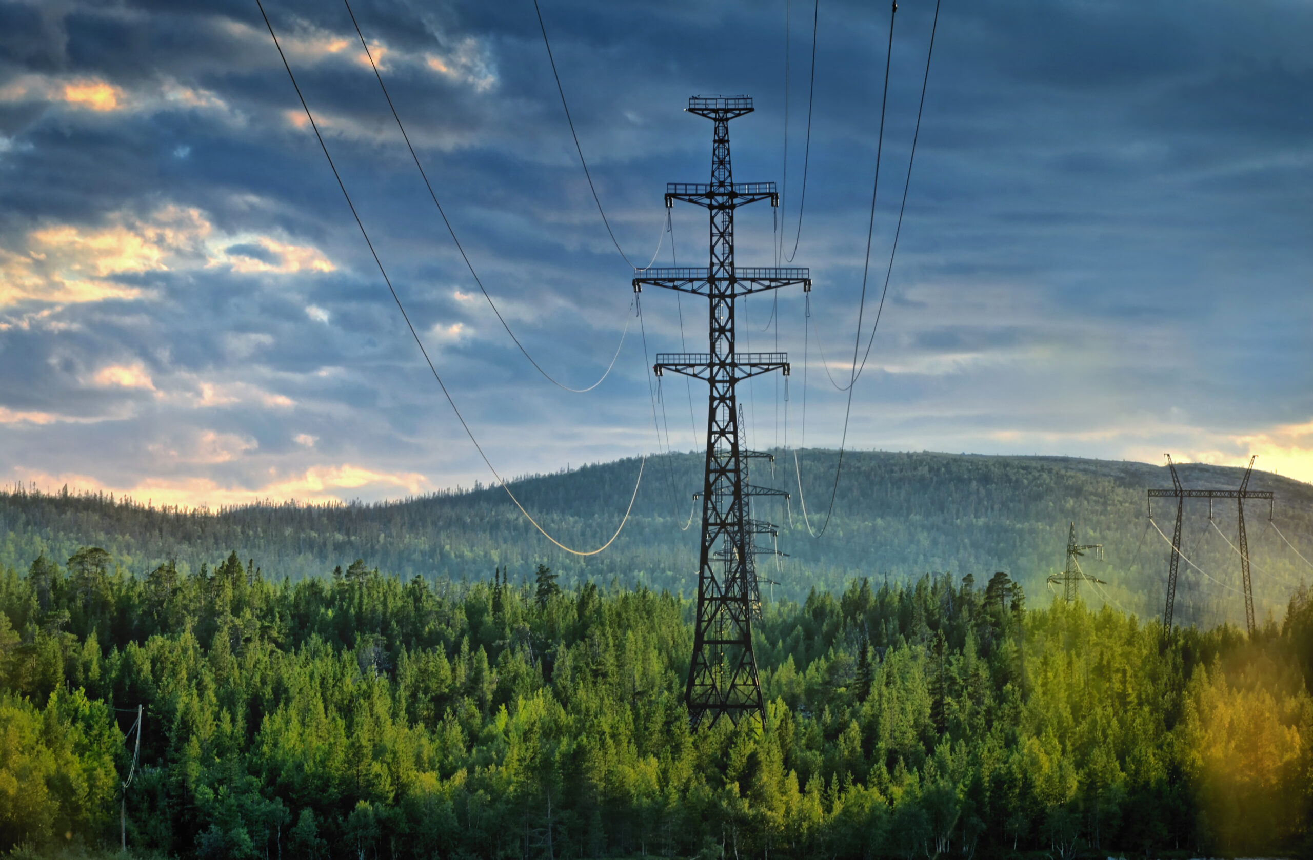
- Power lines
Trees growing near power transmission lines pose a serious threat to utility providers. In extreme weather conditions such as high winds or thunderstorms, falling branches can damage power lines, leading to widespread outages or even sparking fires. Regular maintenance activities—including trimming, hazardous tree removal, and canopy clearance—are essential to mitigate these risks and maintain uninterrupted power supply. - Railways
Along railway corridors, overgrown vegetation can obstruct train operators’ visibility and, in severe cases, trees may fall onto the tracks, causing service disruptions or potentially dangerous accidents. Keeping railway rights-of-way clear and stable through effective vegetation control is critical to ensuring the safety of passengers and the timely delivery of goods. - Roads and industrial zones
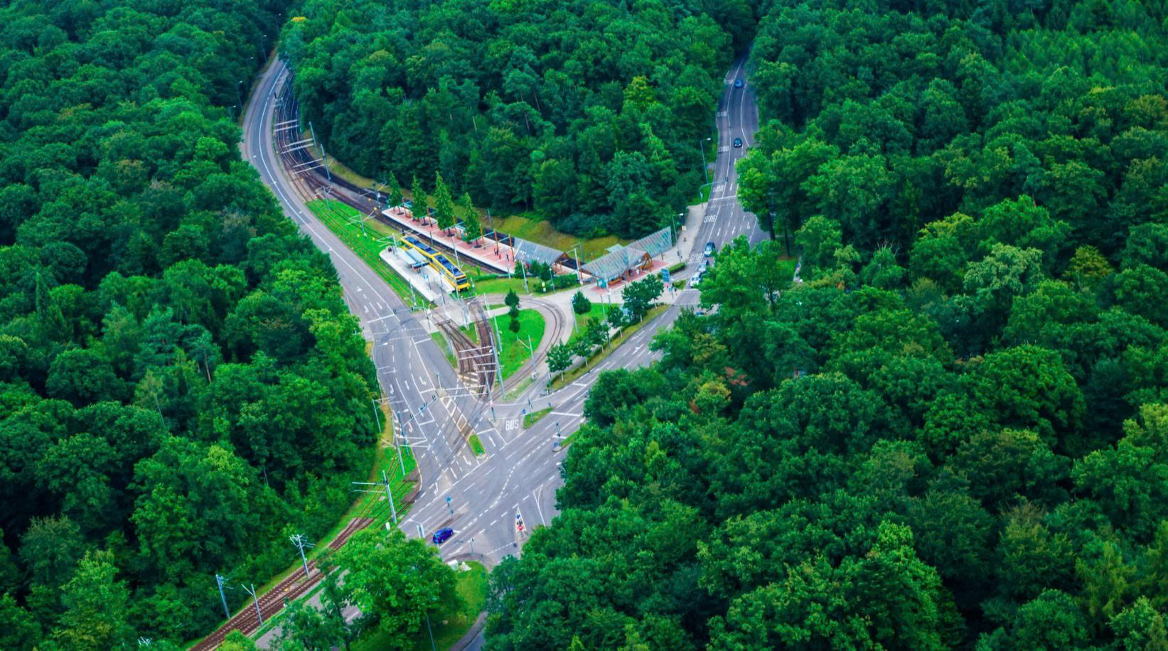
In industrial parks, highways, and internal roads, unchecked vegetation can reduce driver visibility, obscure traffic signs, and interfere with technical systems. Strategic tree management improves operational performance, enhances road safety, and lowers the risk of accidents, contributing to smoother and safer transportation within these vital areas.
Common vegetation management techniques
Depending on the type of infrastructure and surrounding environmental conditions, various methods can be applied to control unwanted vegetation. Each technique has its own advantages and is selected based on effectiveness, cost, and environmental safety:
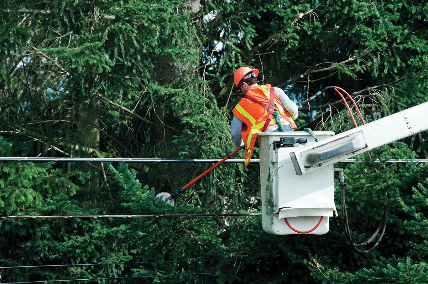
- Manual and mechanical removal:
This includes activities such as trimming, pruning, or complete removal of trees and shrubs. In high-risk areas, such as those near power lines, directional pruning techniques help maintain safe clearance without damaging the tree’s natural growth structure. - Brush removal:
Low vegetation and dry underbrush are highly flammable, especially in arid regions. Eliminating these combustible elements not only protects infrastructure but also significantly reduces the risk of large-scale wildfires that could affect nearby communities. - Herbicide application:
For fast-growing and difficult-to-control invasive species or weeds, the use of herbicides is an effective alternative to manual methods. However, proper application techniques must be followed to ensure minimal impact on surrounding ecosystems. - Tree growth regulators (TGRs):
This is a modern and sustainable solution for vegetation management, particularly in areas with high maintenance costs. TGRs slow down tree growth, reducing the frequency of trimming near power lines or other critical infrastructure. This method not only lowers maintenance costs but also minimizes environmental impact and preserves the tree’s biological structure.
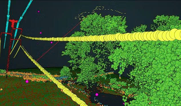
Applications of geospatial technology in vegetation management
Management Significant advances in geospatial technology are driving a transformative shift in vegetation management, especially in areas with critical infrastructure such as power line corridors, railways, road networks, and industrial zones. Modern tools like remote sensing imagery, high-resolution satellite data, UAVs (unmanned aerial vehicles), and Geographic Information Systems (GIS) are increasingly being utilized to monitor vegetation growth over large areas and to identify high-risk zones before issues escalate.
This data-driven approach not only significantly reduces the cost and time associated with manual inspections but also enhances the accuracy of intervention planning. The technology proves particularly effective in monitoring large-scale utility corridors, where continuous vegetation control is essential to prevent service disruptions and ensure public safety.
Effective vegetation control through geospatial technology offers numerous key benefits, including protection of critical infrastructure, reduced wildfire risk, minimized property damage, and enhanced continuity of essential services such as electricity, transportation, and telecommunications.
Emerging Technology Trends in Vegetation Management
- Integration of Artificial Intelligence (AI):
AI algorithms are increasingly deployed to classify vegetation, assess risk levels, and develop automated intervention plans. These machine learning models leverage big data from satellite imagery, UAVs, and ground-based sensors to deliver predictive analytics tailored to the characteristics of each specific area. - Real-time Monitoring:
The integration of IoT sensors and UAVs enables the collection of real-time data to detect early threats posed by vegetation, such as trees at risk of falling, drought-prone areas, or invasive growth near infrastructure. This capability is especially critical in regions frequently affected by natural disasters. - Sustainability-oriented Management:
GIS technology supports the development of environmentally friendly vegetation management strategies by minimizing unnecessary land clearing and promoting biodiversity conservation. This aligns with the broader ESG (Environmental – Social – Governance) goals of sustainable infrastructure development. - 3D Mapping and Digital Twins:
3D GIS and digital twin models allow for accurate simulation of real-world environments, facilitating predictive analysis and effective scenario planning. These tools play a crucial role in strengthening infrastructure resilience and proactive risk mitigation. - Edge Computing:
Data collected from UAVs and IoT devices can be processed locally at the edge, reducing latency and accelerating response times, an essential factor in emergency scenarios. - Cross-platform Integration:
Modern GIS platforms are designed for seamless integration with operational systems such as SCADA, ERP, and asset management systems, creating a closed-loop, intelligent workflow for vegetation and infrastructure management.
Future Applications of Vegetation Management Technologies
- Predictive Maintenance:
Leveraging advanced data analytics from GIS platforms will enable infrastructure operators to forecast risks and implement proactive maintenance strategies, thereby minimizing service downtime and reducing operational costs. - Establishment of Global Standards:
The widespread adoption of GIS technology can contribute to the development of international standards for vegetation management, fostering cross-border collaboration and enhancing the resilience of global infrastructure against increasing environmental risks. - Climate Change Adaptation:
GIS will become a critical tool for industries in responding to climate change by predicting the impact of extreme weather events on vegetation and infrastructure, enabling the implementation of long-term adaptation solutions. - Integration with Autonomous Systems:
In the future, unmanned systems such as UAVs and GIS-enabled robots could fully take over vegetation monitoring, trimming, and clearing, particularly in hazardous, remote, or hard-to-access areas. - Urban Green Space Management:
GIS also supports the planning and maintenance of urban green spaces, optimizing protection for nearby infrastructure from vegetation- or climate-related risks. This approach aligns with smart and sustainable city development strategies. - Enhanced Visualization through AR/VR:
Integrating Augmented Reality (AR) and Virtual Reality (VR) with GIS platforms allows managers and stakeholders to better visualize the current state of vegetation and intervention plans, thereby supporting faster and more informed decision-making.
As infrastructure networks continue to expand into areas with complex terrain and climate conditions, vegetation management has become a critical task to ensure operational safety, continuity, and risk mitigation. Geospatial data, with its ability to deliver comprehensive, accurate, and real-time information, is playing a foundational role in modernizing this process.
The integration of geospatial technologies not only enables early risk detection and optimized resource allocation, but also enhances maintenance efficiency, reduces long-term operational costs, and safeguards communities from potential threats. In the next phase of development, supported by artificial intelligence, IoT sensors, and advanced data analytics, geospatial data will remain a core tool for infrastructure sectors to manage vegetation in a proactive, intelligent, and sustainable manner.