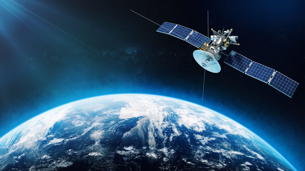
In the digital era, space-based data is no longer the exclusive domain of government agencies or major research institutions. Thanks to Satellite Tasking, the capability to direct satellites to capture imagery on demand, sectors ranging from agriculture and disaster management to national defense are harnessing this customizable data source to make faster and more accurate decisions. No longer constrained by fixed imaging schedules, users can now “order” satellite imagery for specific times and locations, unlocking a new realm of monitoring, rapid response, and resource optimization. So, what are the most common and impactful real-world satellite imagery applications? Let’s explore through the following key examples.
What is satellite imagery?
Satellite imagery refers to data captured by artificial satellites orbiting the Earth, using sensors to record information about the planet’s surface. Unlike conventional camera photographs, satellite images can detect various wavelengths, such as visible light, infrared, or radar, allowing observation of areas obscured by clouds or even at night. This type of imagery is widely used in agriculture, forestry, disaster monitoring, urban planning, and environmental research. A proper understanding of satellite imagery enables us to effectively leverage this valuable data source for a wide range of scientific and practical applications.
A brief history of satellite imagery
Satellite imagery began to develop in the mid-20th century, marking a significant milestone in Earth observation from space. One of the most notable achievements was the Landsat program, launched in 1972 by NASA in collaboration with the U.S. Geological Survey (USGS), which became the first system to provide systematic and continuous images of the Earth over an extended period. Since then, satellite technology has advanced rapidly, with major improvements in image resolution, capture frequency, and the ability to record across multiple spectral bands, including infrared and radar imagery. Today, a wide range of satellite systems such as Sentinel (Europe), MODIS, WorldView, and Planet Labs are widely used across various fields including environmental monitoring, agriculture, resource management, and disaster response.
How do satellites capture images?
Satellites capture images of the Earth using specialized sensors mounted on orbiting platforms. These sensors collect data from the Earth’s surface across various parts of the electromagnetic spectrum, including visible light, infrared, and radar waves. The imaging process consists of four main stages: data acquisition, data transmission, data processing, and image analysis. First, the sensors detect reflected or emitted signals from the Earth’s surface. This data is then transmitted to ground stations via radio waves, either in real time or stored and sent later. Once received, the data undergoes processing to correct for atmospheric interference and sensor-related distortions, ensuring the resulting images are accurate and clear. Finally, the images are analyzed using specialized software and algorithms to support various applications such as forest monitoring, crop tracking, disaster forecasting, and urban management.
Types of satellite imagery
Satellite imagery is highly diverse, designed to serve various observation and analysis needs. Each type of imagery provides distinct information tailored to specific applications:
- Optical imagery captures visible light similar to what the human eye perceives. This is the most common type, offering clear and detailed images ideal for mapping, urban planning, and environmental monitoring.
- Infrared imagery detects heat and emitted energy, enabling monitoring of vegetation health, drought detection, wildfire surveillance, and soil moisture assessment.
- Radar imagery (Synthetic Aperture Radar – SAR) utilizes radio waves and can collect data regardless of weather conditions or lighting, including nighttime and cloudy environments. It is the preferred choice for disaster monitoring such as floods, landslides, and terrain changes.
- Multispectral and hyperspectral imagery capture data across multiple electromagnetic spectrum bands beyond visible light. This type allows detailed analysis of materials, minerals, soil moisture, and crop quality.
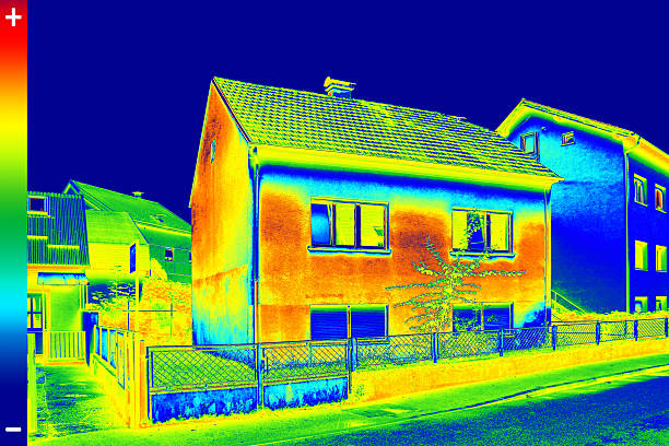
- Thermal imagery focuses on surface temperature variations and is applied in building heat leak inspections, volcanic monitoring, and infrastructure condition assessments.
While not traditional imagery, LiDAR data uses laser pulses to generate precise 3D elevation maps. LiDAR is extremely valuable for forestry management, topographic mapping, infrastructure planning, and autonomous vehicle technology.
Applications of satellite imagery across various fields
Satellite imagery is not only a marvel of modern technology but also a versatile tool supporting numerous industries. Below is a detailed analysis of how different sectors leverage this technology:
Agriculture
Satellite imagery is playing an increasingly critical role in precision agriculture, a field transitioning from traditional farming methods toward data-driven management, supported by remote sensing technology and Geographic Information Systems (GIS). Integrating satellite images into agricultural production enables high-precision monitoring, analysis, and decision-making, thereby enhancing economic efficiency and environmental sustainability.
One of the most prominent applications is monitoring crop health through vegetation indices such as NDVI (Normalized Difference Vegetation Index), EVI (Enhanced Vegetation Index), and NDRE (Normalized Difference Red Edge). These indices, extracted from multispectral and hyperspectral satellite images, help determine photosynthetic activity and detect early signs of stress caused by drought, pests, or nutrient deficiencies, factors not easily visible to the naked eye.
Satellite imagery also plays a role in assessing soil properties and moisture levels, supporting the creation of high-resolution soil maps. Combined with ground sensor data and meteorological models, farmers can make optimized decisions regarding crop rotation, planting schedules, and nutrient requirements.
In yield forecasting, satellite images provide historical and real-time data series used to build statistical or machine learning models to estimate crop production before harvest. This enables agribusinesses and policymakers to effectively manage supply chains, coordinate markets, and respond to risks.
Importantly, precision agriculture systems use satellite imagery to guide Variable Rate Application (VRA) of water, pesticides, and fertilizers, adjusting input amounts specifically for different field zones. This approach not only optimizes costs but also minimizes negative impacts on ecosystems.
Urban planning and real estate
Amid rapid urbanization and increasing demands for sustainable development, satellite imagery has become an indispensable tool in urban planning and real estate, providing accurate, systematic, and continuous spatiotemporal data. The integration of remote sensing technology, Geographic Information Systems (GIS), and satellite images facilitates scientific and efficient urban space planning, monitoring, and management.
A key satellite imagery application is monitoring urban growth through multi-temporal satellite imagery. By analyzing land cover changes and indices such as the Built-up Index, planners can track urban expansion, detect the conversion of agricultural land into built-up areas, and assess infrastructure development levels.
In the real estate sector, satellite data supports spatial analysis for optimal site selection. By evaluating factors such as population density, transportation connectivity, proximity to public services, and natural disaster risks (e.g., flooding, landslides), developers can make more informed investment decisions. Digital Elevation Models (DEM) and infrared imagery also provide critical information on land suitability for construction.
High-resolution satellite imagery is further applied in managing urban infrastructure, including monitoring roads, water supply and drainage systems, bridges, and public utilities. This enables early identification of deteriorating areas to implement timely maintenance, thereby reducing costs and enhancing community safety.
Moreover, in the era of Smart Cities, satellite imagery is integrated with sensor data from IoT systems to support traffic planning, air quality monitoring, waste management, and flexible energy regulation, addressing the increasingly complex needs of urban residents.
Importantly, in disaster risk assessment and response, satellite images play a vital role in vulnerability mapping, evaluating rescue accessibility, and emergency response planning. From an academic perspective, this facilitates the development of spatial analysis models and disaster risk forecasting based on Artificial Intelligence (AI) and Big Data.
Energy and natural resources
Satellite imagery plays a crucial role in the energy sector, from fossil fuel exploration to renewable energy development. In oil and gas exploration, spatial data from satellites is used to analyze geological features and surface anomalies on Earth, enabling precise identification of potential drilling sites. At the same time, satellites support monitoring of ongoing extraction activities, ensuring compliance with environmental regulations and optimizing production efficiency.
In the renewable energy field, selecting optimal locations for solar farms and wind turbines is a decisive factor for energy production efficiency. Satellite data provides vital information on solar irradiance, wind patterns, and terrain conditions, helping researchers and engineers make accurate assessments of operational feasibility and expected output.
Additionally, satellite technology is applied in monitoring oil and gas pipeline networks, with the capability to detect leaks or unauthorized activities promptly, thereby minimizing environmental damage and ensuring operational safety. Finally, in the hydropower sector, satellite imagery assists in tracking water levels and flow rates in reservoirs, enabling effective water resource management for power generation and disaster risk prevention.
Environmental monitoring
Satellite imagery application in environmental monitoring and protection is a mission that has become increasingly urgent amid global climate change and natural resource degradation. Through remote sensing technology, satellites continuously track changes in forest cover, enabling timely detection of illegal logging activities and supporting sustainable forest conservation and management efforts.
In disaster management, satellite imagery provides vital data on damage levels following events such as storms, earthquakes, or floods, facilitating effective emergency response and reconstruction campaigns. Additionally, long-term satellite data is essential for climate change research by monitoring changes in glaciers, sea levels, and atmospheric conditions, helping scientists better understand trends and impacts of this phenomenon.
Satellite imagery is also used in wildlife conservation by monitoring habitats and migration patterns of endangered species. Spectral data analysis from satellites enables identification of specific plant species and assessment of biodiversity, supporting accurate and effective conservation planning. Thus, with its ability to deliver detailed and continuous information about vegetation, land cover, and aquatic ecosystems, satellite imagery has become an indispensable tool in environmental protection initiatives and sustainable development.
Disaster management and response
In the field of disaster management and response, satellite imagery plays a vital role in providing accurate and timely data to support relief efforts. Satellite data enables organizations to monitor damage levels immediately following natural events such as storms, earthquakes, or floods, allowing for swift and effective decision-making.
By integrating GIS technology with satellite imagery, experts can precisely identify affected areas, assess the severity of damage, and develop appropriate evacuation plans to ensure public safety. Satellite images are also used to compare pre- and post-disaster conditions, enabling detailed evaluation of damage to infrastructure and the environment. This information is essential for resource allocation, prioritizing repair zones, and formulating recovery plans, thereby enhancing response efficiency and minimizing losses.
Maritime and transportation
In the maritime and transportation sector, satellite imagery provides crucial solutions for effective monitoring and management of vast ocean areas. Satellite tracking enables continuous surveillance of global shipping routes, ensuring smooth flow of goods while enhancing maritime security by recording vessel movements and locations at sea.
Satellite images also play a key role in detecting and preventing illegal, unreported, and unregulated (IUU) fishing activities, protecting marine ecosystems from overexploitation and unauthorized harvesting. Additionally, satellite data supports logistics optimization at seaports, aiding in congestion management and efficient coordination of maritime traffic.
In emergency situations such as accidents or incidents at sea, satellites help accurately locate distressed vessels, facilitating rapid and effective search and rescue operations, thereby ensuring the safety of lives and cargo on the water.
Insurance
In the insurance industry, satellite imagery is increasingly utilized to enhance risk assessment accuracy and optimize claims processing. By analyzing geographic features combined with historical data, insurance companies can more precisely determine the risk levels associated with assets, thereby setting premium rates that accurately reflect the real conditions and potential hazards faced by those assets.
Satellite images also support objective and rapid claims verification, especially following natural disasters such as storms, floods, or wildfires. Damage assessment through satellite data helps shorten claim processing times while reducing the risk of fraud during compensation procedures.
Moreover, disaster modeling based on satellite imagery enables prediction of potential impacts of natural hazards on insured assets, allowing businesses to manage risks more effectively. Regular satellite monitoring of insured properties further helps detect emerging risks, such as environmental changes from deforestation or nearby urban development, ensuring insurance policies remain aligned with evolving realities.
Retail and marketing
In the retail and marketing sector, satellite imagery plays a crucial role in providing precise spatial data to support strategic decision-making. Analyzing location data based on customer traffic and competitor presence enables retailers to select optimal store locations, thereby enhancing business efficiency and tailoring marketing strategies effectively.
Additionally, satellite images are used to determine the best placement for outdoor advertising boards by analyzing visibility and foot traffic, ensuring advertisements reach the target audience and maximize communication impact.
In supply chain management, monitoring infrastructure and transportation networks from space helps businesses coordinate logistics more efficiently, reducing costs and improving delivery times. Furthermore, satellite data supports the identification of emerging markets and assessment of regional demand, facilitating scientifically grounded and strategic market expansion and development planning.
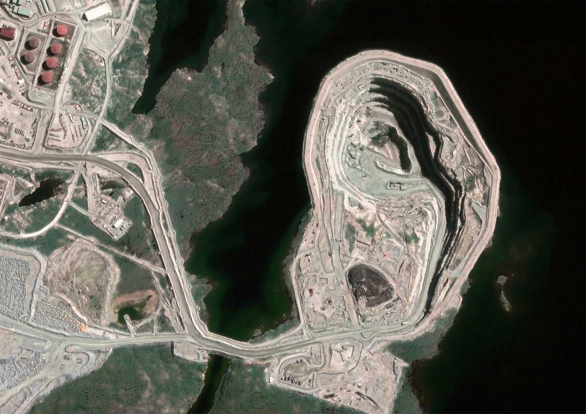
Mineral extraction
In the mining and natural resource sector, satellite imagery has made significant advances in optimizing processes and enhancing management efficiency. Satellites support mineral exploration by analyzing geological features and surface indices, reducing the need for costly and time-consuming ground surveys.
Once extraction activities commence, satellite images are used for continuous monitoring of on-site operations to ensure compliance with environmental regulations and to optimize mining processes. Additionally, satellite data enables accurate assessment of environmental impacts by tracking land deformation, water quality, and changes in vegetation cover, helping companies minimize negative effects on the surrounding environment.
Furthermore, remote monitoring contributes to increased safety at mining sites by early detection of potential hazards and ensuring strict adherence to safety standards. Finally, satellite imagery supports greater transparency in the mineral supply chain by tracking resource transportation from mines to markets, addressing conflict mineral issues and promoting sustainable management.
Healthcare and epidemiology
In the field of public healthcare and epidemiology, satellite imagery plays an increasingly vital role in enhancing surveillance capacity and responding to health challenges on a large scale. Thanks to remote sensing and high-resolution satellite image analysis, experts can monitor environmental factors such as vegetation, water sources, soil moisture, and surface cover, elements closely linked to the spread of infectious diseases like malaria, dengue fever, and waterborne microbial illnesses.
In the event of natural disasters, satellite images enable rapid assessment of damage to healthcare infrastructure and assist in identifying priority areas for relief efforts, ensuring medical response operations are efficient and timely. Moreover, satellite data supports research on food security and nutrition by monitoring crop yields and changes in agricultural environments—contributing to accurate evaluations of food shortages and nutritional risks.
In urban areas, satellite imagery facilitates monitoring of phenomena such as urban heat islands and the distribution of green spaces, helping assess environmental impacts on public health. The integration of epidemiological information with geospatial satellite data provides a comprehensive overview, aiding public health authorities in making scientifically informed decisions regarding resource allocation, policy design, and real-time disease control. The close collaboration between GIS technology and satellite imagery opens a modern, effective approach to protecting public health.

Telecommunications
The modern telecommunications industry leverages the power of satellite imagery to optimize network performance and enhance customer service on a global scale. Through remote sensing technology and high-resolution satellite images, network planners can identify ideal locations for deploying base stations, optical fiber routes, and other infrastructure, ensuring broad and stable coverage, especially in remote or hard-to-reach areas.
Beyond planning, satellite imagery supports monitoring the physical condition of telecommunications networks – from cables and transmission stations to supporting structures – enabling operators to perform proactive maintenance, prevent failures, and improve service reliability. In cases of natural disasters or major incidents, satellite data plays a critical role in rapid damage assessment, facilitating swift restoration of communication links.
Furthermore, satellite information assists regulators and telecom companies in tracking land use changes, urban expansion, and infrastructure development, which supports efficient frequency management and resource coordination. The integration of geographic spatial analysis from satellite imagery with advanced telecommunication systems not only delivers real-time data but also enables quick processing and distribution of information to monitoring and decision-making platforms.
The convergence of satellite imagery and telecommunication networks increases spatial analysis accuracy and introduces a new paradigm where big data, AI, and remote sensing work together to enhance infrastructure management, planning, and control in the digital era.
Scientific research and exploration
Scientific research and space exploration are entering a new era thanks to the integration of satellite imagery and advanced GIS technology. With the ability to collect global, real-time data, satellite images provide a valuable repository of information supporting diverse scientific fields, from geography and ecology to climate science and geology.
Analyzing spectral properties, spatial resolution, temporal resolution, and spectral depth enables researchers to perform highly accurate land cover classification, detect environmental changes such as forest degradation, soil erosion, or polar ice melting. Simultaneously, this data supports modeling of natural and anthropogenic processes, from surface water flow and tectonic movements to urbanization, enhancing understanding of Earth’s dynamic systems.
In exploration, satellite imagery expands capabilities to identify buried archaeological sites, locate potential mineral deposits, or analyze surfaces of other planets in the Solar System. The integration of multispectral, hyperspectral, and radar sensors with spatial analysis allows scientists to reach unprecedented levels in global research.
Moreover, GIS technology enables the aggregation, visualization, and simulation of satellite data within interactive environments, opening new avenues for forecasting models and long-term impact analyses of climate change or human interventions. As technology advances, satellite imagery not only broadens our understanding of the planet but also plays a crucial role in developing strategies for sustainable natural resource management and environmental protection.
Military and defense applications
Military and defense operations increasingly rely on satellite imagery and GIS for precise, real-time intelligence. High-resolution satellite images enhance battlefield surveillance by monitoring troop movements and infrastructure changes, improving situational awareness and tactical coordination. Detailed terrain data supports mission planning, route optimization, and risk assessment. Satellites also aid in target verification and post-strike damage analysis, while enabling continuous border surveillance to detect unauthorized activities. When integrated with radar, satellite systems strengthen early warning capabilities and missile defense by tracking launches and guiding interception efforts.
The synergy between satellite imagery, GIS, and artificial intelligence (AI) is propelling the advancement of geospatial intelligence (GEOINT), delivering a strategic edge and bolstering agile response capabilities to address the increasingly complex security challenges of the 21st century.
The future of satellite imagery
The future of satellite imagery is ushering in a transformative era shaped by automation, interactivity, and sustainability. Moving beyond their traditional role as Earth observation tools, next-generation satellites are evolving into intelligent, adaptive sensing platforms capable of dynamically adjusting data acquisition modes based on real-time ground conditions.
With the integration of edge computing and artificial intelligence (AI) directly onboard satellites, initial data processing can be performed in orbit before transmission to Earth. This significantly reduces latency and enhances responsiveness in time-sensitive scenarios such as disaster response, military operations, or environmental monitoring.
A notable trend is the development of modular satellite architectures that allow for in-orbit upgrades, reconfiguration, or component replacement. These innovations not only extend satellite lifespan but also address the growing concern of space debris by minimizing the need for frequent satellite replacement.
Furthermore, the adoption of open-source data protocols and cloud-based data delivery platforms is democratizing access to satellite imagery. No longer restricted to government agencies or large corporations, these advances empower research institutions, startups, and civil society organizations to harness geospatial data for innovation and impact.
Whether optimizing global supply chains, supporting climate action in remote areas, or enabling precision agriculture, the satellite imagery systems of the future will serve not just as “eyes in the sky,” but as intelligent partners in the pursuit of a more sustainable and equitable planet.
If you’re interested in satellite tasking on our GEOHUB platform, please leave your information in the consultation form. Our geospatial experts will get in touch and support you promptly!