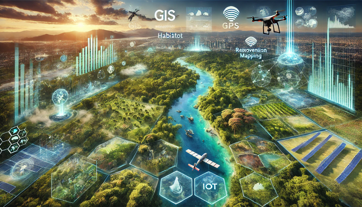
Geospatial technology is increasingly asserting its vital role in the monitoring, assessment, and effective management of natural resources. With its ability to integrate data from remote sensing, Geographic Information Systems (GIS), and satellite imagery, it provides a comprehensive view of environmental changes across both space and time. This empowers policymakers, regulatory agencies, and researchers to make data-driven decisions, thereby enhancing the management of land, water resources, forests, minerals, and other ecosystems.
This article highlights the role of geospatial technology in natural resource management and introduces specific applications that support sustainable development planning and address urgent environmental challenges.
Benefits of environmental monitoring from space
Environmental monitoring is essential across various sectors such as mineral extraction, agriculture, forestry, and infrastructure development to comply with legal regulations, meet environmental standards, and support sustainable investment. While field data collection remains a common method, it is often costly and limited in both spatial and temporal scope.
Satellite remote sensing is emerging as a superior solution due to its ability to provide extensive, continuous, and real-time data coverage. This technology enables effective monitoring of environmental changes, resource management, and impact assessment with high accuracy, offering a sustainable and comprehensive approach to environmental surveillance.
The role of geospatial technology in natural resource management
Management Natural resources play a vital role in maintaining ecological balance and driving long-term economic growth. The sustainable and rational use of resources such as land, water, forests, and minerals is not only fundamental to sustainable development but also an urgent requirement amid climate change and biodiversity loss.
Geospatial technologies, including Geographic Information Systems (GIS), Remote Sensing (RS), and the Global Positioning System (GPS), are increasingly proving to be key tools in the management of natural resources. These technologies enable the collection, analysis, and real-time visualization of spatial data, effectively supporting the monitoring of resource dynamics, assessment of current conditions, and forecasting of land use trends.
By integrating multi-source data and enabling large-scale spatial analysis, geospatial technologies empower policymakers and resource managers to make evidence-based decisions, thereby enhancing the effectiveness of conservation efforts and promoting the sustainable exploitation of natural resources.
Natural resource mapping and inventory
Mapping and inventory of natural resources form the foundation for effective planning and sustainable management. By integrating data from satellite imagery, aerial photography, and Geographic Information Systems (GIS), it is possible to create high-accuracy spatial maps that visually represent the distribution, area, and changes of key resources such as forests, surface water, agricultural land, and minerals.
These thematic maps provide a scientific basis for assessing current resource conditions and support land-use planning and policy development. For example, monitoring forest cover over time helps detect deforestation hotspots early, enabling timely conservation measures and carbon emission reductions, critical components in global climate change mitigation efforts.
Environmental monitoring and conservation
Geospatial technology plays a crucial role in monitoring environmental changes and supporting effective strategies for natural resource conservation. Through data collected from multispectral remote sensing satellites, researchers can analyze indicators such as vegetation health, surface temperature, water quality, and air pollution levels. This data enables the assessment of environmental impacts from human activities, identification of degraded areas, and the formulation of appropriate ecological restoration measures.
In addition, geospatial technology is applied in monitoring protected areas, detecting encroachment, illegal exploitation, or wildlife poaching. Combining satellite imagery with GPS tracking devices attached to animals allows for precise monitoring of migration patterns, habitats, and species adaptation to climate change. Such information serves as a vital scientific foundation for designing habitat restoration programs, managing conservation zones, and proactively safeguarding biodiversity in a sustainable manner.
Sustainable agriculture and forestry
Geospatial technology has become an essential tool in promoting sustainable agricultural and forestry practices. Through Geographic Information Systems (GIS) and remote sensing data, farmers and forest managers gain access to detailed insights on soil fertility, moisture levels, crop health, and ecosystem dynamics. This information forms the basis for precision agriculture, enabling optimized application of fertilizers and pesticides to increase productivity, reduce operational costs, and minimize environmental and human health impacts.
In forestry, geospatial technology supports effective forest inventory, planning, and monitoring. By integrating GIS with topographic and hydrological indicators, suitable areas for reforestation and afforestation can be identified. Remote sensing imagery also enables early detection of risks such as pest outbreaks, wildfires, and illegal logging, thereby facilitating timely decision-making to preserve forest integrity and maintain long-term biodiversity.

Natural resource exploration and management
By integrating remote sensing data, topographic maps, and geological information within a GIS environment, organizations can identify potential mineral-rich zones, supporting efficient and environmentally responsible extraction planning in line with regulatory standards.
Beyond mining, geospatial technology also plays a key role in assessing renewable energy potential. Analysis of solar radiation, wind speed, and terrain conditions enables the identification of optimal locations for solar and wind power plants. This supports the advancement of sustainable energy strategies, reduces reliance on fossil fuels, and contributes to environmental protection and climate change adaptation.
Disaster management and risk assessment
Geospatial technology plays a pivotal role in disaster risk management and enhancing response capabilities. It enables authorities to rapidly map hazard zones, develop evacuation plans, locate critical assets, and allocate emergency resources efficiently in events such as floods, earthquakes, wildfires, and landslides.
Beyond emergency response, geospatial data supports proactive risk forecasting and mitigation. By analyzing spatial data in conjunction with topographic, geological, climatic, and historical disaster information, high-risk areas can be identified with precision. These insights provide a scientific basis for sustainable land-use planning, climate-resilient infrastructure design, and disaster risk reduction strategies, ultimately strengthening community resilience to climate change and natural hazards.

Policy planning and decision support
Geospatial technology is increasingly recognized as a vital tool for policy development and data-driven decision-making. Integrating spatial information with economic, social, and environmental factors allows policymakers to assess impacts over space and time, ensuring that planning is grounded in real-world conditions.
Tools such as GIS and remote sensing enable scenario modeling, data visualization, and trend analysis, enhancing transparency and communication effectiveness. Additionally, geospatial solutions support priority setting, strategic resource allocation, and policy implementation monitoring, contributing to the sustainable and accountable management of natural resources.
Wildlife conservation
Geospatial technology plays an increasingly vital role in wildlife conservation by enabling habitat mapping, species distribution monitoring, and the identification of ecologically significant areas. GIS systems, when integrated with GPS tracking data, allow for the monitoring of animal migration patterns and habitat use. This information supports the design of ecological corridors that reconnect fragmented habitats disrupted by infrastructure development or land-use changes.
Spatial analysis of biodiversity “hotspots” and areas at risk of degradation helps prioritize conservation efforts. Additionally, geospatial technology assists in assessing extinction risks and developing policies to manage human-wildlife conflicts, especially in the context of climate change and accelerating deforestation. As a result, geospatial tools have become indispensable in protecting ecosystems and ensuring long-term ecological balance.
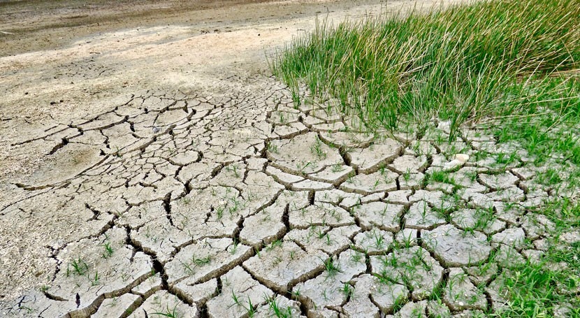
Desertification and land degradation
Monitoring Severe environmental challenges are threatening land usability and global food security. Through satellite imagery and remote sensing data, researchers can detect changes in vegetation cover, soil moisture, and surface structure over time. Indicators such as the Normalized Difference Vegetation Index (NDVI), Land Surface Dryness Index (LSDI), and GIS-based spatial models enable early detection of areas showing signs of degradation or severe erosion.
This data supports the assessment of the extent and rate of desertification and provides a scientific foundation for land restoration policies and sustainable land-use strategies. Local governments and conservation organizations can use these insights to prioritize resource allocation, implement reforestation programs, manage water resources efficiently, and promote sustainable agricultural practices tailored to local climate and soil conditions. Thanks to its capacity for large-scale, continuous, and precise monitoring, geospatial technology is becoming an essential tool in the global fight against land degradation and in safeguarding terrestrial ecosystems.
Towards a green future with geospatial technology
Geospatial technology is not merely a supporting tool, it is a core driving force behind the transition to a modern, accurate, and sustainable model of natural resource management. From monitoring forests, soil, and water to tracking natural disasters, biodiversity, and climate change, advancements in GIS, remote sensing, and spatial analysis are enabling a deeper understanding of the complex interactions between humans and the environment.
As the world faces increasingly complex challenges, such as resource depletion, environmental pollution, and climate change, the application of geospatial technologies is no longer optional but a critical necessity. To fully unlock its potential, there must be a long-term commitment to investment in research and development, the establishment of digital infrastructure, open data sharing, and the promotion of international collaboration.
Equally important is fostering geospatial literacy among younger generations and local communities, which forms the foundation for inclusive and comprehensive development. Only through the synergy of technology, people, and policy can we effectively safeguard our planet’s precious natural resources and move toward a greener, more equitable, and harmonious future. In this endeavor, geospatial technology serves as a digital compass, guiding humanity on its journey to build a truly sustainable planet for generations to come.