After being affected by Tropical Storm No. 11 – Matmo, many areas along the Cầu and Thương rivers were submerged under extensive floodwaters. By October 19, 2025, Sentinel-2 satellite imagery recorded encouraging signs: floodwaters had largely receded, agricultural fields were gradually recovering, and transportation had returned to normal.
This article by VEGACOSMOS provides a detailed analysis of the latest satellite data, enabling readers to visualize the overall recession process while demonstrating how remote sensing technology supports effective disaster monitoring and response in Vietnam.
Overview of the Post–Typhoon No. 11 (Matmo) Flood Event
Following the landfall of Tropical Storm No. 11 – Matmo, the Cầu and Thương River basins experienced nearly two weeks of sustained flooding, severely affecting transportation and agricultural production in Bắc Giang, Bắc Ninh, and Thái Nguyên provinces.
By the morning of October 19, 2025, Sentinel-2 imagery provided by the European Space Agency (ESA) indicated that inundation had decreased significantly, with many previously submerged areas now dry.
This article compiles the most recent satellite imagery, analyzes the water recession trend, and highlights the practical value of remote sensing technology in disaster monitoring in Vietnam.
👉 See previous: Updated Flood Monitoring at Cầu and Thương River Basins on October 14, 2025
Flood Dynamics Observed from Satellite Imagery
Satellite data from two sources—Sentinel-1 (SAR) and Sentinel-2 (optical)—were used to compare flood conditions between October 14 and October 19, 2025.
All datasets were processed and analyzed by VEGACOSMOS remote sensing specialists.
-
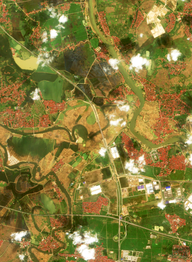
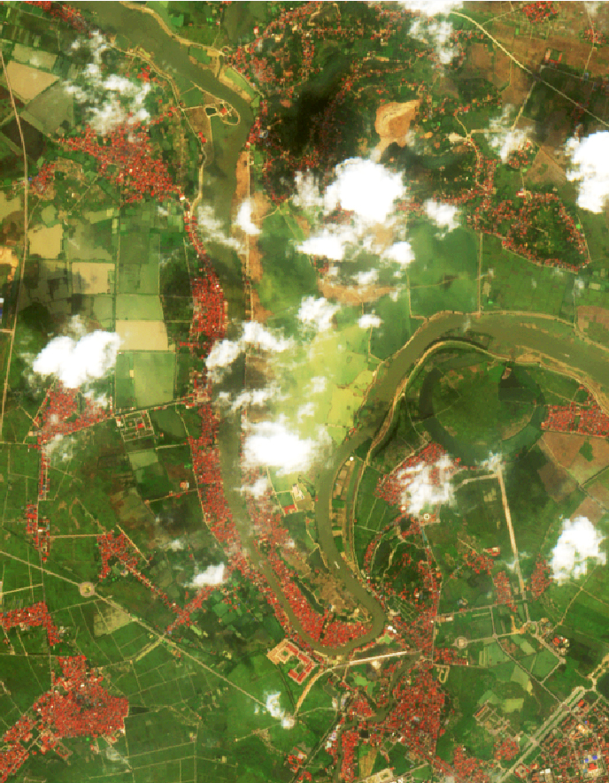
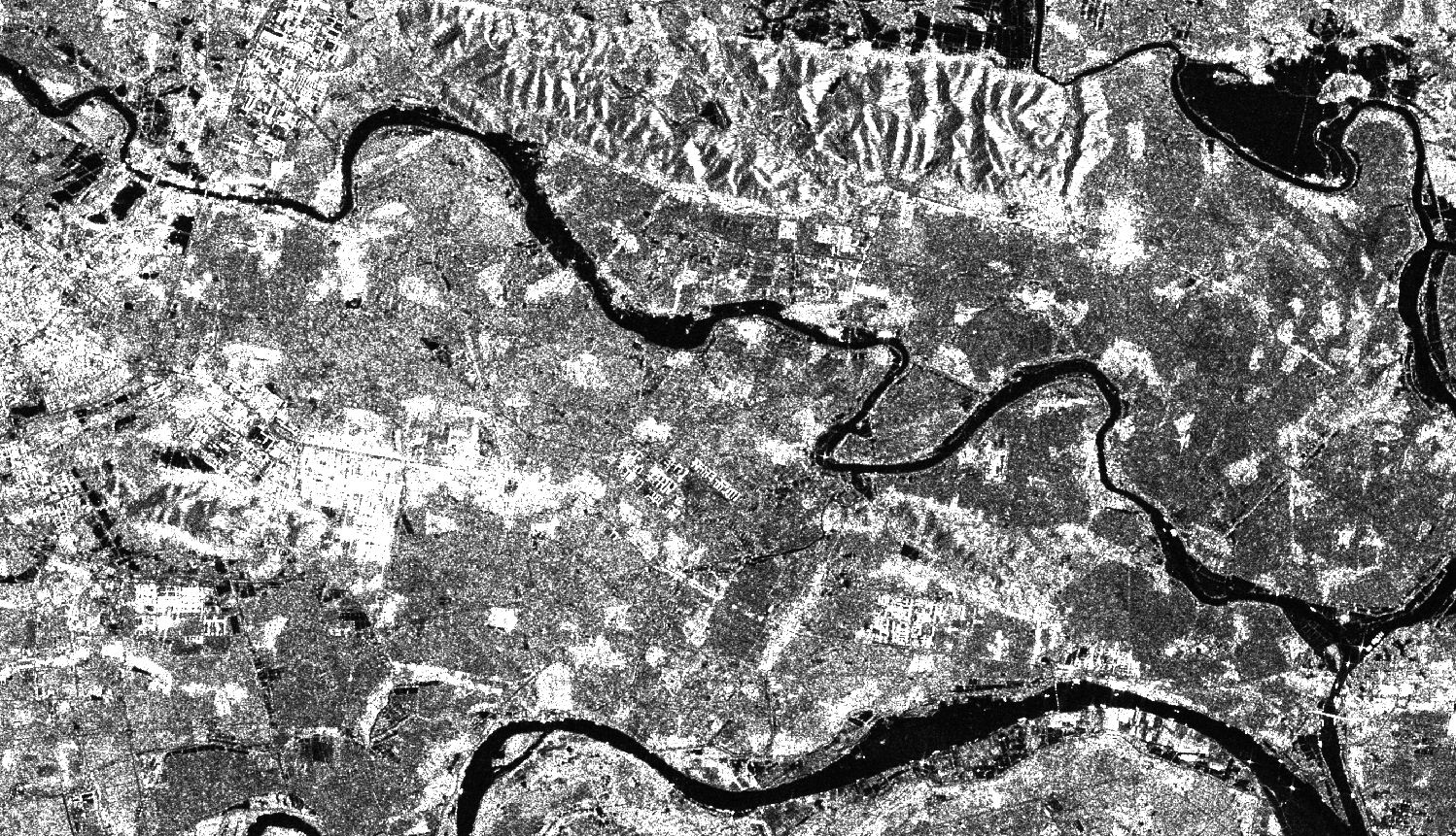
Overview of Cầu–Thương River Basins
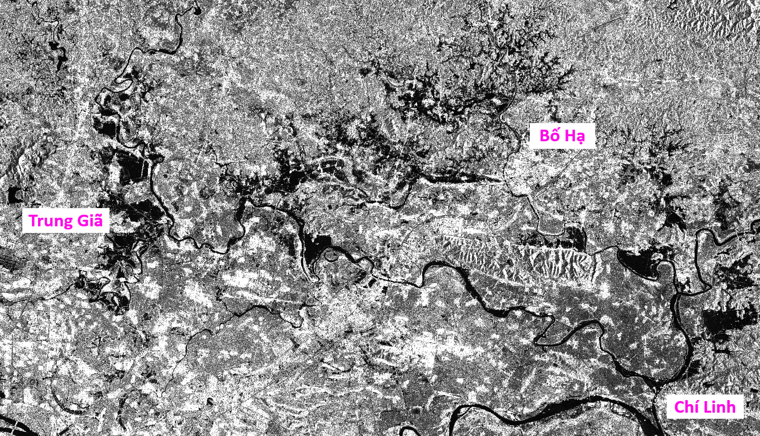
(1a)
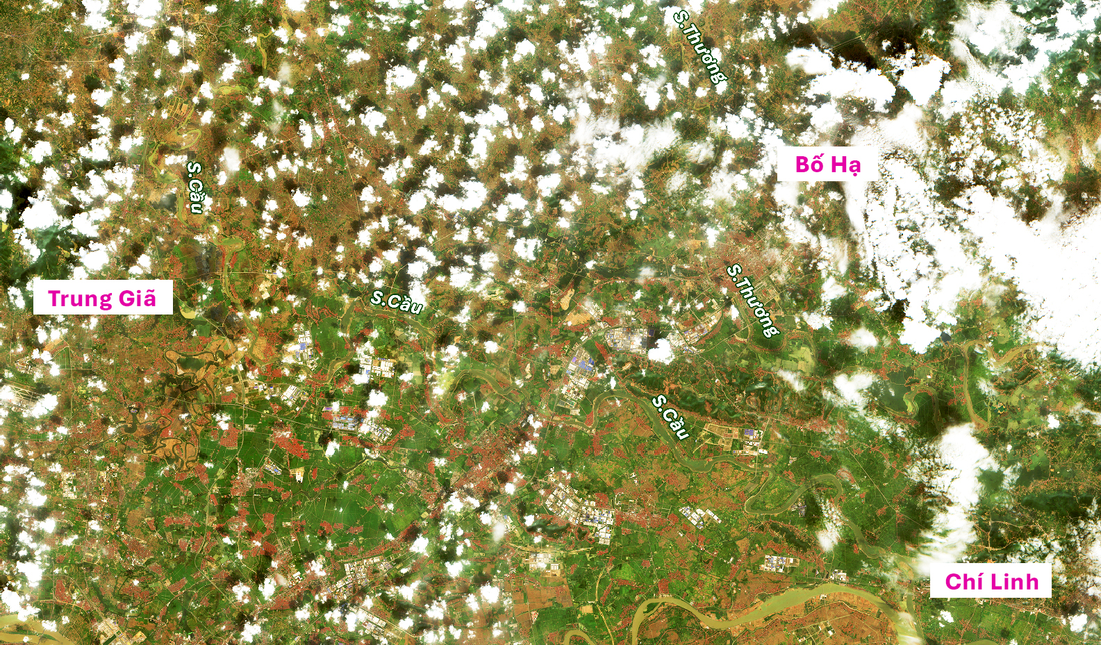
(1b)
Overview of Thương and Cầu river basins. (1a) Sentinel-1 imagery acquired at 4:51 AM on October 14 and (1b) Sentinel-2 imagery acquired at 10:27 AM on October 19, 2025.
-
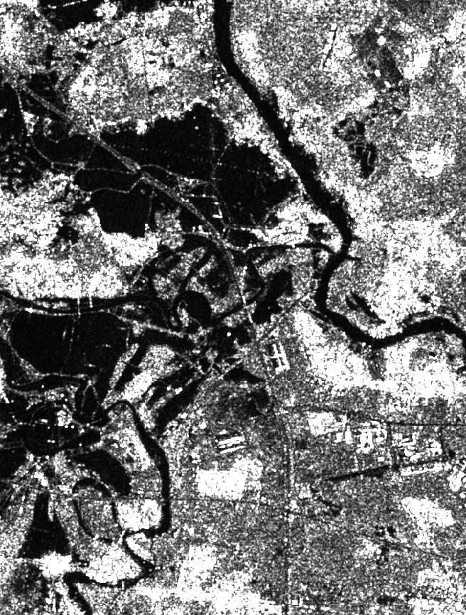
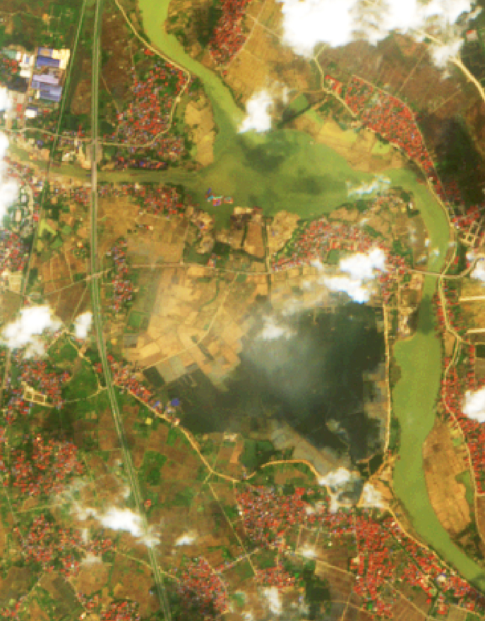
Bố Hạ Town, Bắc Ninh

(2a)

(2b)
Small village in Bố Hạ Town (2a) on the morning of October 14 and in (2b) on the morning of October 19. By October 19, areas observable in the Sentinel-2 image (not obscured by cloud cover) were no longer inundated.
-
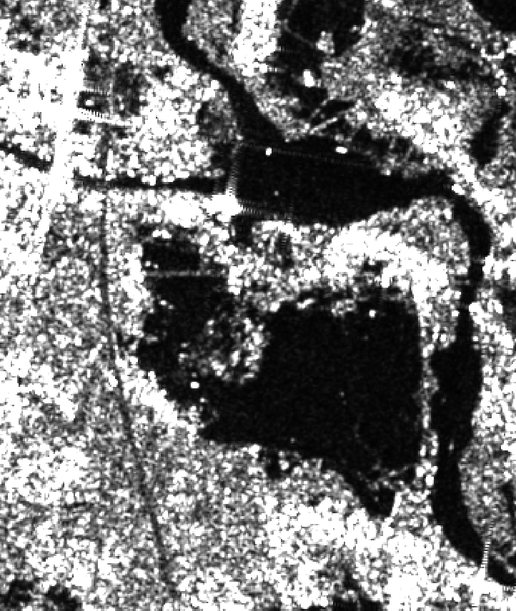
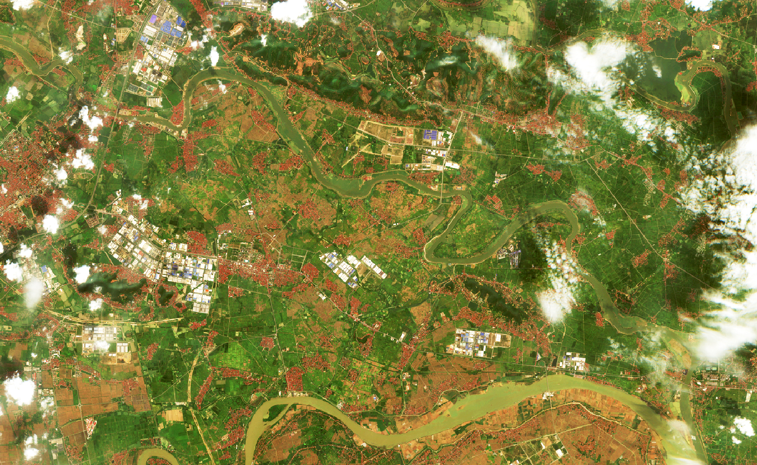
Lower Thương River and Thái Bình River Area

(3a)
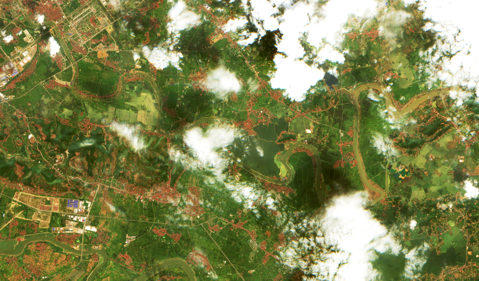
(3b)
The lower reach of Thương River at its confluence with Thái Bình River (3a) on the morning of October 14 and (3b) on the morning of October 19. Some fields remained waterlogged, likely representing low-lying agricultural land.
-
Hà Nội – Thái Nguyên Expressway and Surrounding Areas
 |
 |
| (4a) | (4b) |
Hà Nội – Thái Nguyên (HN–TN) Expressway area (4a) on the morning of October 14 and (4b) on the morning of October 19. The inundated extent had decreased substantially, with flooding persisting only in certain agricultural fields.
-
Road 296 – An Lạc Hamlet
 |
 |
| (5a) | (5b) |
Road 296, connecting the HN–TN Expressway to An Lạc Hamlet, (5a) on the morning of October 14 and (5b) on the morning of October 19. Some plains remained inundated.
-
Vân Hà and the Lower Cầu River Basin
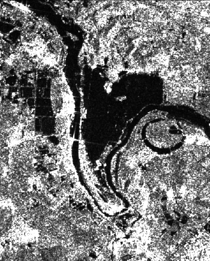 |
 |
| (6a) | (6b) |
Vân Hà area (6a) on the morning of October 14 and (6b) on the morning of October 19. As of October 19, flooding persisted in several fields.
(7a)
(7b)
Lower Cầu River area (7b) on the morning of October 19 showed little change compared to (7a) on October 14. Field outside the right-bank levee of lower Cầu River basin dried out.
Overall Assessment: Flooding Nearly Substantially Receded
Analysis of the Sentinel-1 (SAR) and Sentinel-2 (optical) time series indicates that:
- Floodwaters receded progressively from upstream to downstream;
- Residential areas were no longer isolated;
- Only a few low-lying fields retained elevated water levels.
This flood event lasted nearly two weeks, significantly impacting agricultural production and transportation infrastructure, particularly along the Hà Nội – Thái Nguyên Expressway.
The Role of Remote Sensing Technology in Disaster Monitoring
The application of satellite imagery for flood monitoring provides substantial practical benefits:
- Wide-area observation: A single Sentinel image can cover the entire river basin within minutes.
- Frequent monitoring: Revisit intervals of 3–5 days enable close tracking of flood evolution.
- High reliability: The integration of SAR (Sentinel-1) and optical (Sentinel-2) data allows flood detection even under cloudy conditions.
- Support decision-making: Remote sensing data provide objective evidence to support disaster response, mitigation planning, and rapid damage assessment.
Post-Matmo flood event highlights the critical importance of satellite technology in disaster risk management. Remote sensing data not only enhance monitoring and forecasting accuracy but also strengthen the proactive response capacity of authorities and local communities.
Source: VEGACOSMOS