After Tropical Storm No. 11 – Matmo weakened and moved inland, its residual circulation continued to bring prolonged heavy rainfall, causing severe flooding across the Cầu and Thương River basins. By October 14, 2025, imagery acquired from the Sentinel-1 (ESA) and STRIX (Synspective) satellites indicated a marked reduction in inundated areas, with significant water recession observed in many locations.
This article by VEGACOSMOS team provides a detailed analysis based on SAR and optical satellite data, enabling readers to visualize the overall flood dynamics, the extent of water recession, and the practical applications of remote sensing technology in disaster monitoring in Vietnam.
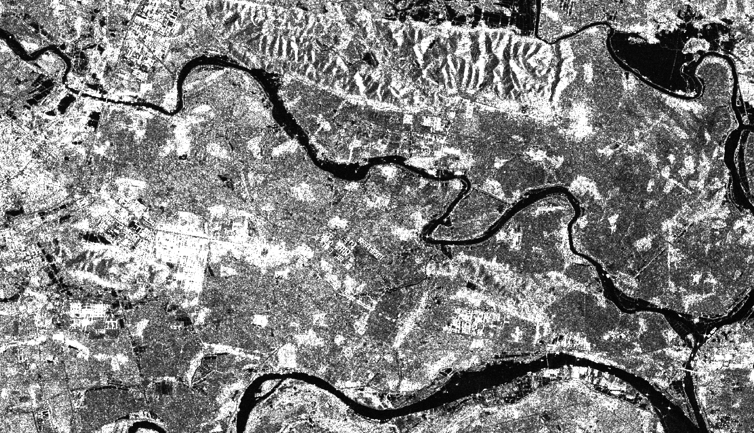
Overview of Flood Development as of October 14, 2025
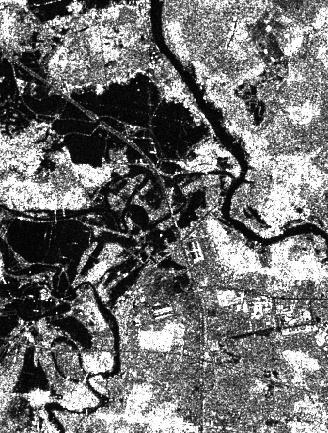
As of October 11, 2025, many areas along the Cầu and Thương rivers remained deeply inundated, and transportation was disrupted.
However, newly acquired radar data from the Sentinel-1 satellite (C-band SAR, 10 m spatial resolution, provided by ESA) on the morning of October 14, 2025, show a significant decrease in flooded areas in the lower Thương River basin. Meanwhile, localized inundation persisted in parts of the lower Cầu River basin.
👉 See more: Satellite-Based Assessment of Flood Conditions Along Thương River After Typhoon Matmo
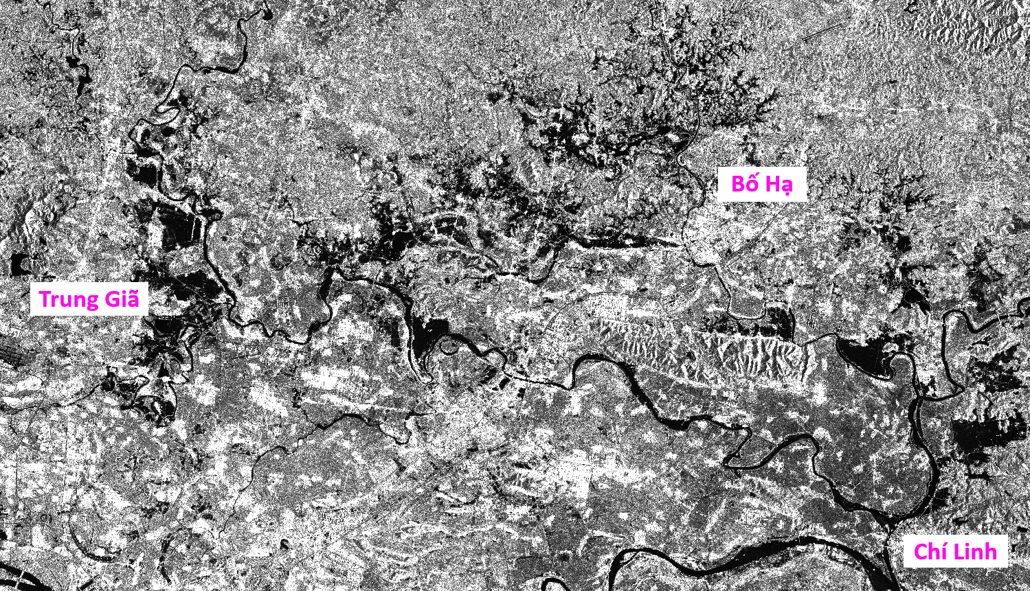
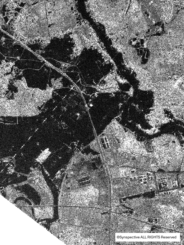
Overview of Thương and Cầu river basins on Sentinel-1 imagery at 4:51 AM on October 14, 2025. In the image, dark areas represent open water and inundation.
Detailed Analysis Based on Satellite Imagery
Yên Thế Area (Bắc Ninh Province)
(2a)

(2b)
In the Yên Thế area, (2a) Sentinel-2 imagery from the morning of October 11, 2025, and (2b) Sentinel-1 imagery from the morning of October 14, 2025, shows that inundated areas had substantially decreased.
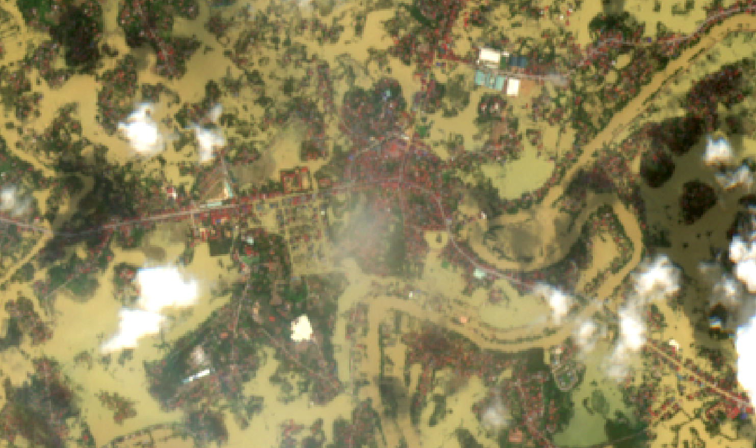
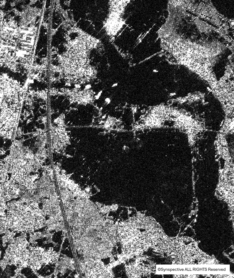
Bố Hạ Town (Yên Thế, Bắc Ninh)

(3a)

(3b)
A small village in Bố Hạ Town (3a) on the morning of October 11, 2025, and (3b) on the morning of October 14, 2025. On October 11, several villages were still isolated by floodwaters. By October 14, floodwaters had receded, restoring access to most villages, although flooded areas remained relatively extensive.
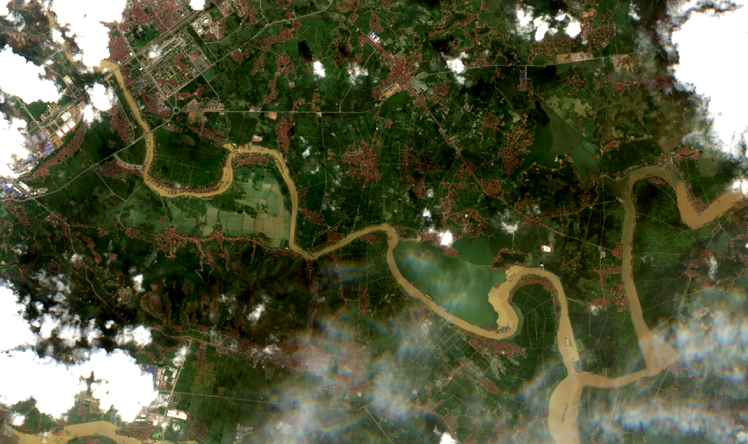
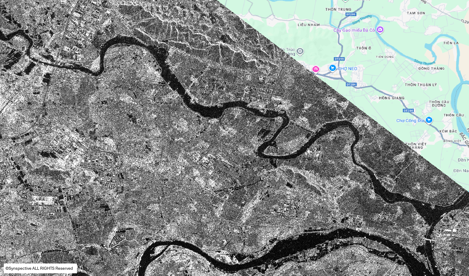
Downstream Thương – Thái Bình River
(4a)
(4b)
The lower reach of Thương River at its confluence with Thái Bình River (4a) on the morning of October 11, 2025, and (4b) on the morning of October 14, 2025. The river’s water surface had narrowed compared to October 11, indicating a decrease in water level.
Hà Nội – Thái Nguyên Expressway Area
 |
 |
| (5a) | (5b) |
Hà Nội – Thái Nguyên (HN–TN) Expressway area (5a) from STRIX (Synspective) SAR imagery acquired around 2:00 AM on October 11, 2025, and (5b) from Sentinel-1 imagery on the morning of October 14, 2025. In the Sentinel-1 image, it is difficult to determine whether the expressway recovered from flooding due to the 10 m spatial resolution limitation. However, the overall reduction in inundated extent and river surface area indicates continued water recession.
Road 296 – An Lạc Hamlet (Đa Phúc, Hà Nội)
 |
 |
| (6a) | (6b) |
Road 296, from the HN–TN Expressway to An Lạc Hamlet, (6a) around 2:00 AM on October 11, 2025, and (6b) on the morning of October 14, 2025. Although water had receded, inundated areas remained relatively extensive.
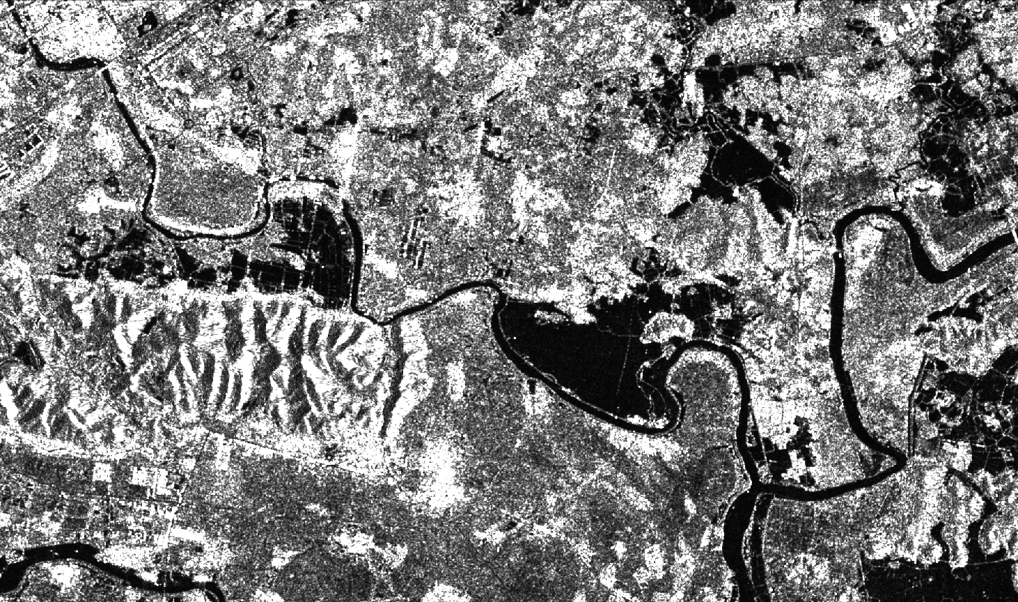
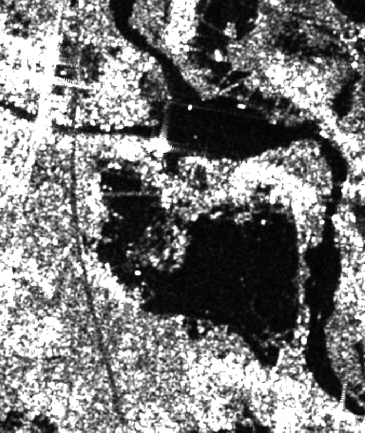
Vân Hà Area and Lower Cầu River Basin
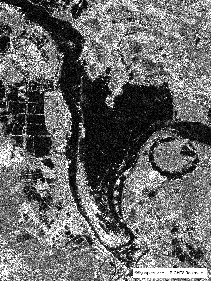 |
 |
| (7a) | (7b) |
Vân Hà area (Bắc Ninh) (7a) at around 2:00 AM on October 11, 2025, and (7b) on the morning of October 14, 2025. The reduction in inundated area was minimal, indicating slower drainage in this locality.
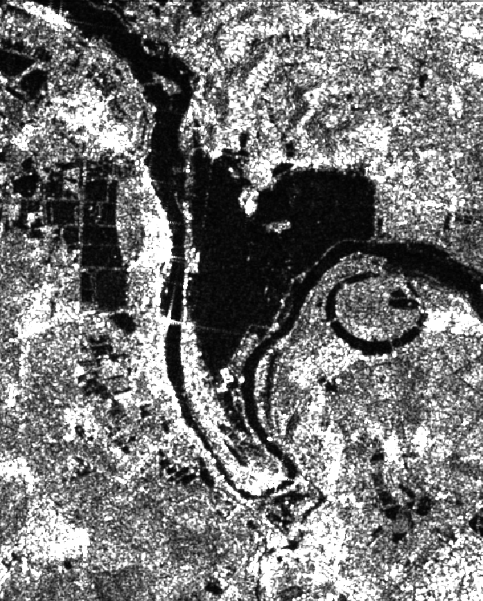
(8a)
(8b)
No new flood hotspots were detected in the lower Cầu River basin. Compared to (8a) from around 2:00 AM on October 11, 2025, the emergence of a mid-channel sandbar at the Cầu–Thương river confluence in (8b) on the morning of October 14, 2025, indicates a decline in river water levels (basemap: Google Maps).
Conclusion
By October 14, 2025, floodwaters in Cầu and Thương river basins had receded significantly, particularly in Yên Thế, Bố Hạ, and the lower Thương River. Some areas, such as Vân Hà and An Lạc, still experienced localized standing water, but the overall trend of water level decline was evident.
Optical and SAR remote sensing data enable relatively frequent monitoring of flood dynamics. Sentinel-1 SAR data, with a 10 m spatial resolution, are effective for large-area flood mapping but remain limited for detailed monitoring tasks, such as assessing flood conditions along specific road segments. For high-resolution, local-scale monitoring, commercial high-resolution SAR data can provide more detailed and actionable information.
Source: VEGACOSMOS.