Google Maps has long been a leader in digital navigation, providing directions and detailed location information to users around the world. In recent years, Google has introduced a range of new features that leverage geospatial technology and artificial intelligence to enhance the user experience. These updates not only support existing services but also introduce new capabilities that promise to transform the way we interact with our surroundings.
Below are some of the most notable features and an analysis of how geospatial technology is applied in each:
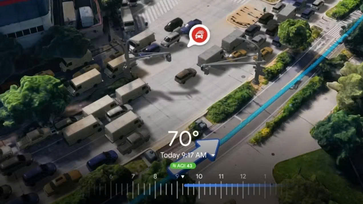
Immersive View for Routes
The Immersive View for Routes feature on Google Maps is a prime example of the application of advanced geospatial technologies to enhance user interaction and support effective spatial decision-making. This feature allows users to visualize their entire travel route through an intuitive 3D interface, vividly simulating real-world environments with high geographical and urban morphological accuracy.
From a technological perspective, Immersive View aggregates geospatial data from multiple sources, including high-resolution satellite imagery, Street View data, digital elevation models (DEMs), cadastral maps, and real-time traffic data. These datasets are processed using artificial intelligence (AI) and deep learning algorithms to reconstruct highly detailed three-dimensional virtual environments that reflect the true structure of urban landscapes, infrastructure systems, and local environmental conditions.
The application of geospatial technology in this feature not only helps users plan routes more efficiently but also provides valuable tools for urban planning, mobility behavior analysis, and assessments of spatial factors affecting travel. Notably, the ability to simulate landscapes based on time of day and specific weather conditions enables researchers, planners, and citizens to access spatial information in a more immersive, contextual, and comprehensive manner.
Immersive View for Routes exemplifies the growing trend of integrating geospatial technology with AI to deliver next-generation mapping services, moving beyond traditional navigation functions toward building multidimensional digital map platforms that serve the needs of smart cities and sustainable development.
Places Insights
The Places Insights feature in Google Maps is a prime example of how geospatial technology can be utilized to extract in-depth information about behaviors, trends, and activity patterns at specific locations. This feature draws on data from Google’s global digital mapping ecosystem, integrating diverse spatial sources such as GPS coordinates, Street View imagery, basemaps, traffic flows, and user-generated reviews. By combining real-time spatial data layers in both two and three dimensions, Places Insights delivers both quantitative and qualitative analyses regarding location popularity, peak times, accessibility, and the socio-geographic characteristics of places.
Geospatial technology plays a central role in standardizing, synchronizing, and analyzing location-based data through spatial coordinates. It employs spatial analysis techniques such as overlay analysis, spatial clustering, and location-based behavior modeling. This enables Places Insights to assist individual users in making informed choices about destinations, while also providing strategic value to businesses and urban managers for assessing spatial performance, designing customer engagement strategies, and planning public services.
When integrated into large-scale data analytics platforms, Places Insights can extract information at regional or temporal scales, thereby supporting socio economic forecasting models, local market research, and assessments of spatial influences on consumer behavior. Thus, Places Insights exemplifies the powerful role of geospatial technology in linking data, space, and behavior, three essential components of modern smart city planning and development.
Geospatial AR Content
The Geospatial AR Content feature on Google Maps represents a significant advancement in the integration of geospatial technology with augmented reality (AR), offering a novel, accurate, and context-rich spatial interaction experience. By combining GPS positioning, 3D terrain models, satellite imagery, and high-resolution Street View data, Google Maps enables precise localization of a user’s device in the real world, allowing digital content, such as navigation cues, place information, or virtual signage, to be overlaid directly onto the physical environment via an AR interface.
Geospatial technology plays a central role in ensuring the spatial accuracy and contextual alignment of AR content. Specifically, spatial localization algorithms leverage digital map data in conjunction with computer vision techniques to match real-world scenes with Google’s global imagery database, thereby determining the device’s exact position and orientation in 3D space. As a result, AR objects are correctly anchored to their real-world locations, remain stable within the spatial context, and dynamically adapt to user movements in real time.
This capability not only enhances personal navigation in complex urban environments but also enables valuable academic and commercial applications, such as interactive tourism guides, orientation support for the visually impaired, location-based advertising, and spatial education through immersive visualization. In the context of smart city development, Geospatial AR Content demonstrates the potential of integrating multilayered spatial data, from imagery and maps to positional sensors, to support decision-making, foster social interaction, and enrich spatial awareness in a comprehensive and effective manner.
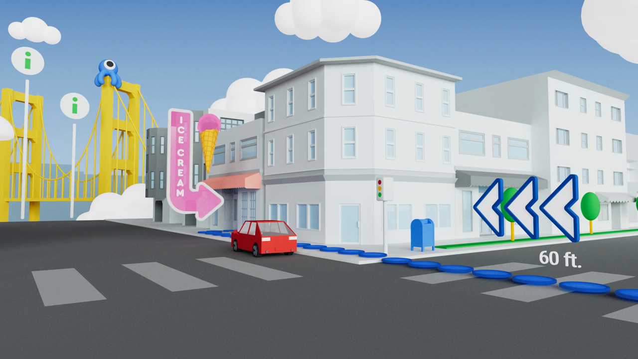
AR Possibilities with Lens in Maps
The AR Possibilities with Lens in Maps feature leverages the integration of geospatial technology, computer vision, and augmented reality (AR) to enhance spatial interaction experiences. Using the device’s camera, Google Lens identifies landmarks, storefronts, or buildings and overlays relevant information directly onto the real-world view through an AR interface.
Geospatial technology serves as the foundational layer by combining GPS data, digital maps, Visual Positioning System (VPS), and Street View imagery to accurately determine the user’s location and viewing direction. This enables digital content to be precisely anchored to its real-world spatial position, delivering an immediate, intuitive, and context-rich user experience.
This feature exemplifies the emerging trend of merging spatial data with AR technologies to support navigation, information retrieval, and urban exploration in a more visual and efficient manner. In modern urban environments, such integration significantly enhances user engagement and spatial awareness.
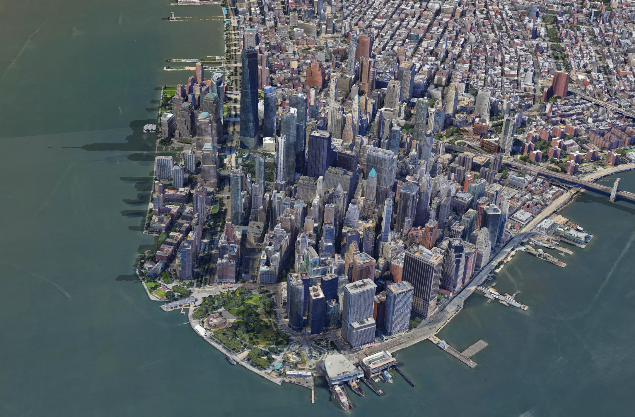
Photorealistic 3D Tiles in Google Maps Platform
The Photorealistic 3D Tiles feature on the Google Maps Platform represents a significant advancement in applying geospatial technology to recreate urban environments with high detail and realism. This feature utilizes aerial imagery, satellite data, and LiDAR sensors to generate 3D models based on a tile-based structure, dividing space into manageable square data units optimized for real-time retrieval and rendering.
Geospatial technology plays a central role in collecting, processing, and georeferencing these three-dimensional spatial data layers. The system employs photogrammetry techniques combined with standardized geographic coordinates to construct terrain and building models with high positional and morphological accuracy. Consequently, 3D objects are precisely localized within the geographic space, supporting applications such as urban planning, environmental simulation, location-based gaming, and VR/AR training.
Beyond enhancing spatial visualization, this feature lays the groundwork for advanced spatial analyses, including viewshed analysis, shadow simulation, and spatial impact assessment. Photorealistic 3D Tiles exemplify the trend toward comprehensive digitalization of physical spaces within virtual environments, unlocking broad application potential across engineering, architecture, urban management, and spatial sciences.
Weather API
The Weather API on the Google Maps Platform exemplifies the application of geospatial technology in delivering real-time weather data linked to precise locations. By integrating meteorological data from global forecast models, observation stations, and satellites, the Weather API provides detailed weather information, including temperature, humidity, precipitation, wind, and cloud cover, based on accurate geographic coordinates.
Geospatial technology plays a critical role in locating, analyzing, and visualizing weather data spatially. The use of standardized geographic coordinate systems, combined with data layering capabilities on base maps, enables users to access weather information contextualized with spatial factors such as terrain, ecosystems, population centers, or transportation routes.
This feature is particularly valuable in fields like precision agriculture, disaster risk management, urban planning, and logistics operations, where weather conditions directly influence decision-making. Supported by geospatial technology, the Weather API not only delivers isolated weather metrics but also expands spatial-temporal analysis capabilities, offering comprehensive and context-rich insights.
What’s Next for Google Maps?
Recent updates from Google Maps highlight the rapid advancement of geospatial technology in modern digital life. Google is evolving beyond its traditional role as a provider of maps and navigation, progressively transforming into a comprehensive spatial data platform that supports individuals, businesses, and urban governments alike. The integration of artificial intelligence (AI), photorealistic 3D data, and real-time spatiotemporal analytics has opened new directions for map experiences, ranging from intelligent navigation and immersive spatial simulations to enhanced planning and decision support.
These innovations not only redefine how humans interact with the physical world but also play a critical role in shaping the structure and development of future cities globally.